alb4512613
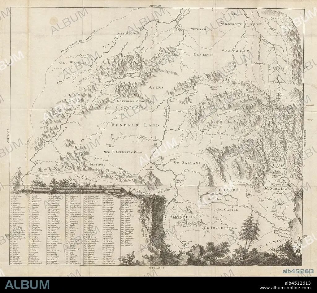
Map of Eastern Switzerland, Map of Grisons, Uri, Glarus, Appenzell, Zurich with inscription of the mountains, etching, plate 15, after S. IX (part 2), 1760, Gottlieb Sigmund Gruner: Die Eisgebirge des Schweizerlandes. Bern: Abraham Wagner, Sohn. 1760.
| Partager |
|---|
 Pinterest Pinterest |
 Twitter Twitter |
 Facebook Facebook |
 Copier le lien Copier le lien |
 Email Email |
|
Ajouter à une autre Lightbox |
|
Ajouter à une autre Lightbox |


Avez-vous déjà un compte? S'identifier
Vous n'avez pas de compte ? S'inscrire
Acheter cette image.
Sélectionnez l'usage:

Légende:
Voir la traduction automatique
Map of Eastern Switzerland, Map of Grisons, Uri, Glarus, Appenzell, Zurich with inscription of the mountains, etching, plate 15, after S. IX (part 2), 1760, Gottlieb Sigmund Gruner: Die Eisgebirge des Schweizerlandes. Bern: Abraham Wagner, Sohn. 1760.
Crédit:
Album / quintlox
Autorisations:
Taille de l'image:
5778 x 5045 px | 83.4 MB
Taille d'impression:
48.9 x 42.7 cm | 19.3 x 16.8 in (300 dpi)
Mots clés:
9E SIECLE • 9EME S • BERNE • CARTE (GEOGRAPHIE) • CARTE GEOGRAPHIQUE • CARTE • CHAINE DE MONTAGNES • CORDILLÈRE • DESSIN PLANS • INSCRIPTION • MASSIF • PLAN (CARTOGRAPHIE) • PLANS
