alb8369703
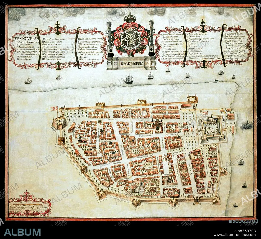
India / Denmark: Map of Tranquebar (Tharangambadi) showing Fort Dansborg, Giorf af Gregers,1733, The Royal Library, Copenhagen
| Partager |
|---|
 Pinterest Pinterest |
 Twitter Twitter |
 Facebook Facebook |
 Copier le lien Copier le lien |
 Email Email |
|
Ajouter à une autre Lightbox |
|
Ajouter à une autre Lightbox |


Avez-vous déjà un compte? S'identifier
Vous n'avez pas de compte ? S'inscrire
Acheter cette image.
Sélectionnez l'usage:

Titre: India / Denmark: Map of Tranquebar (Tharangambadi) showing Fort Dansborg, Giorf af Gregers,1733, The Royal Library, Copenhagen
Légende: Voir la traduction automatique
Tharangambadi, formerly Tranquebar, is a town in the Nagapattinam district of the Indian state of Tamil Nadu. It lies 15 kilometres (9.3 mi) north of Karaikal, near the mouth of a distributary of the Kaveri River.
. It was a Danish colony from 1620 to 1845, and in Danish it is still known as Trankebar.
Crédit: Album / Universal Images Group / Pictures From History
Autorisations: ? Autorisation de modèle: Non - ? Autorisation de propriété: Non
Questions sur les droits?
Questions sur les droits?
Taille de l'image: 4700 × 4073 px | 54.8 MB
Taille d'impression: 39.8 × 34.5 cm | 1850.4 × 1603.5 in (300 dpi)
Mots clés: 18 18E 18EME XVIII XVIIIE XVIIIEME SIECLE • 18E SIECLE • 18EME S • CARTE (GEOGRAPHIE) • CARTE GEOGRAPHIQUE • CARTE • CARTES • CARTOGRAPHIE • COLONIALISME • DANOIS • DANOISE • DESSIN PLANS • DIX-HUITIÈME SIÈCLE • IMPERIALISME • INDE • INDES • INDIEN • INDIENNE • INDIENS • METIER • PLAN (CARTOGRAPHIE) • PLANS • SCIENCE: CARTOGRAPHIE • TAMIL NADU • XVIIIE SIECLE
