alb8363585
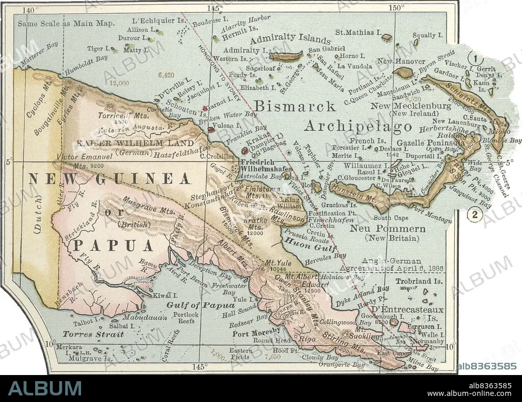
Map of New Guinea and Bismarck Archipelago
| Partager |
|---|
 Pinterest Pinterest |
 Twitter Twitter |
 Facebook Facebook |
 Copier le lien Copier le lien |
 Email Email |
|
Ajouter à une autre Lightbox |
|
Ajouter à une autre Lightbox |


Avez-vous déjà un compte? S'identifier
Vous n'avez pas de compte ? S'inscrire
Acheter cette image.
Sélectionnez l'usage:

Légende:
Voir la traduction automatique
Map of New Guinea and Bismarck Archipelago
Crédit:
Album / Universal Images Group / Encyclopaedia Britannica
Autorisations:
Modèle: Non - Propriété: Non
Questions sur les droits?
Questions sur les droits?
Taille de l'image:
4419 x 3180 px | 40.2 MB
Taille d'impression:
37.4 x 26.9 cm | 14.7 x 10.6 in (300 dpi)
Mots clés:
ANNEES 1990 • ANNEES QUATRE-VINGT-DIX • ARCHIPEL • CARTE (GEOGRAPHIE) • CARTE GEOGRAPHIQUE • CARTE • CARTOGRAPHIE • DESSIN PLANS • DETAIL • EXPLORATION • GEOGRAPHIE • HISOIRE • HISTOIRE • HORIZONTALE • ILE • ÎLES • MONT • MONTAGNE • MONTAGNES • OCEANIE • PLAN (CARTOGRAPHIE) • PLANS • SCIENCE: CARTOGRAPHIE • XIXE SIÈCLE
