alb5400279
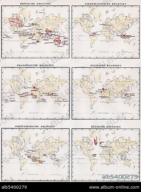
Historic illustration, world maps showing the colonies of Great Britain, Netherlands, France, Spain, Portugal and Denmark, 19th century, Meyers Konversations-Lexikon encyclopedia, 1889, Europe.
| Partager |
|---|
 Pinterest Pinterest |
 Twitter Twitter |
 Facebook Facebook |
 Copier le lien Copier le lien |
 Email Email |
|
Ajouter à une autre Lightbox |
|
Ajouter à une autre Lightbox |


Avez-vous déjà un compte? S'identifier
Vous n'avez pas de compte ? S'inscrire
Acheter cette image

Légende:
Voir la traduction automatique
Historic illustration, world maps showing the colonies of Great Britain, Netherlands, France, Spain, Portugal and Denmark, 19th century, Meyers Konversations-Lexikon encyclopedia, 1889, Europe
Crédit:
Album / ImageBroker / H.-D. Falkenstein
Autorisations:
Modèle: Non - Propriété: Non
Questions sur les droits?
Questions sur les droits?
Taille de l'image:
465 x 600 px | 817.4 KB
Taille d'impression:
3.9 x 5.1 cm | 1.6 x 2.0 in (300 dpi)
Mots clés:
ANGLETERRE • CADRE • CAGE A LAPINS • CARTE ROUTIERE • CARTE • CARTES • CARTON • COLONIE • ESPAGNE • GEOGRAPHIE • HAARLEM, (NL) • HAARLEM, HOLLANDE • HISTOIRE HOLLANDE • HOLLANDE HAARLEM • HOLLANDE HISTOIRE • HOLLANDE • HOLLANDE, HISTOIRE • ILLUSTRATION • IMAGES • INTERIEUR: TABLEAUX • MAPPEMONDE • MONTRER • PAYS BAS • PAYS-BAS • PAYS-BAS, PAYSAGE • PAYSAGE: PAYS-BAS • PEINDRE • PEINTURE, SCENES D'INTERIE • PLANISPHERE • PORTUGAL • TABLEAU: SCENES D'INTERIEU • TABLEAUX
