alb1463736
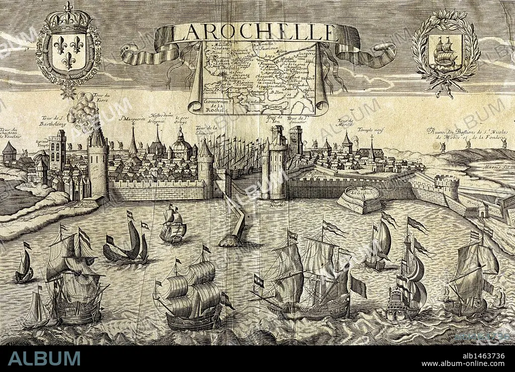
La Rochelle. Map of the city on the Atlantic. Sixteenth-century engraving by Jollain.
| Partager |
|---|
 Pinterest Pinterest |
 Twitter Twitter |
 Facebook Facebook |
 Copier le lien Copier le lien |
 Email Email |
|
Ajouter à une autre Lightbox |
|
Ajouter à une autre Lightbox |


Avez-vous déjà un compte? S'identifier
Vous n'avez pas de compte ? S'inscrire
Acheter cette image.
Sélectionnez l'usage:

Légende: Voir la traduction automatique
La Rochelle. Map of the city on the Atlantic. Sixteenth-century engraving by Jollain.
La Rochelle. Map of the city on the Atlantic. Sixteenth-century engraving by Jollain.
Crédit: Album / Prisma
Autorisations: ? Autorisation de modèle: Non - ? Autorisation de propriété: Non
Questions sur les droits?
Questions sur les droits?
Taille de l'image: 4983 × 3345 px | 47.7 MB
Taille d'impression: 42.2 × 28.3 cm | 1961.8 × 1316.9 in (300 dpi)
Mots clés: 16E SIECLE • 16EME S • BATEAU EMBARCATIONS • BATEAUX • CARTE (GEOGRAPHIE) • CARTE GEOGRAPHIQUE • CARTE • CARTOGRAPHIE • CÔTE • DESSIN PLANS • EMBARCATIONS • EMBARQUEMENT • FLOTTE • FRANCE • FRAVURE • GRAVURE • HISOIRE • HISTOIRE • LA ROCHELLE • LITTORAL • MANOIR • MARITIME • MER • NAVIGATION MARITIME ET FLUVIALE • NAVIGATION • OCCIDENTAL • OCCIDENTAUX • OCEAN ATLANTIQUE • OCEAN • PAYSAGE MARITIME • PLAN (CARTOGRAPHIE) • PLANS • PLANTE • SCIENCE: CARTOGRAPHIE • SEIZIÈME SIÈCLE • URBANISME • VEGETAUX • VILLA • WESTERN • XVIE SIECLE
