alb5405114
Joan Blaeu, Bermuda Map, 17th Century
| Partager |
|---|
 Pinterest Pinterest |
 Twitter Twitter |
 Facebook Facebook |
 Copier le lien Copier le lien |
 Email Email |
|
Ajouter à une autre Lightbox |
|
Ajouter à une autre Lightbox |


Avez-vous déjà un compte? S'identifier
Vous n'avez pas de compte ? S'inscrire
Acheter cette image.
Sélectionnez l'usage:

Titre:
Joan Blaeu, Bermuda Map, 17th Century
Légende:
Voir la traduction automatique
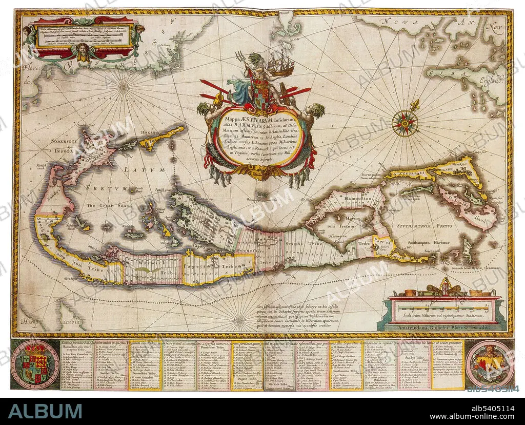
Bermuda is a British Overseas Territory in the North Atlantic Ocean. In 1609, the English Virginia Company permanently settled Bermuda in the aftermath of a hurricane, when the crew and passengers of the Sea Venture steered the ship onto the surrounding reef to prevent its sinking, then landed ashore. The island was administered as an extension of Virginia by the Company until 1614. Its spin-off, the Somers Isles Company, took over in 1615 and managed the colony until 1684. At that time, the company's charter was revoked, and the English Crown took over administration. The islands became a British colony following the 1707 unification of the parliaments of Scotland and England, which created the Kingdom of Great Britain. Joan Blaeu (1596-1673) was a Dutch cartographer, the son of cartographer Willem Blaeu. In 1635 they published the Atlas Novus (full title: Theatrum orbis terrarum, sive, Atlas novus) in two volumes.
Crédit:
Album / Science Source
Autorisations:
Taille de l'image:
4200 x 3177 px | 38.2 MB
Taille d'impression:
35.6 x 26.9 cm | 14.0 x 10.6 in (300 dpi)
Mots clés:
17E SIECLE • 17EME S • CARTE • CARTOGRAPHIE • CÉLÈBRE • CELEBRITE • DIX-SEPTIÈME SIÈCLE • GEOGRAPHIE • NAVIGATION • PORTULAN • SCIENCE: CARTOGRAPHIE • XVIIE SIECLE
