alb4267932
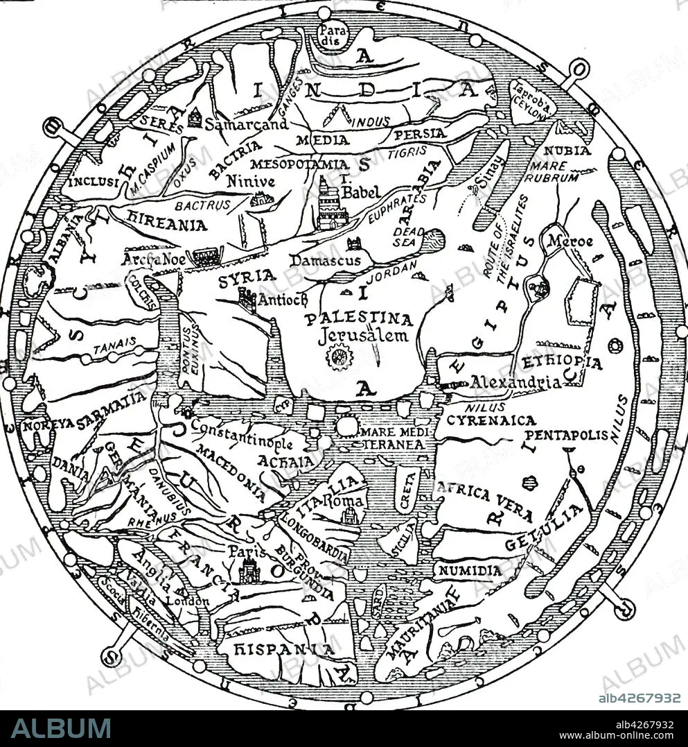
An engraving depicting the central section of the Hereford Mappa Mundi, a medieval map of the known world. Dated 14th century
| Partager |
|---|
 Pinterest Pinterest |
 Twitter Twitter |
 Facebook Facebook |
 Copier le lien Copier le lien |
 Email Email |
|
Ajouter à une autre Lightbox |
|
Ajouter à une autre Lightbox |


Avez-vous déjà un compte? S'identifier
Vous n'avez pas de compte ? S'inscrire
Acheter cette image.
Sélectionnez l'usage:

Légende: Voir la traduction automatique
An engraving depicting the central section of the Hereford Mappa Mundi, a medieval map of the known world. Dated 14th century
An engraving depicting the central section of the Hereford Mappa Mundi, a medieval map of the known world. Dated 14th century
Crédit: Album / Universal Images Group / Universal History Archive
Autorisations: ? Autorisation de modèle: Non - ? Autorisation de propriété: Non
Questions sur les droits?
Questions sur les droits?
Taille de l'image: 4509 × 4652 px | 60.0 MB
Taille d'impression: 38.2 × 39.4 cm | 1775.2 × 1831.5 in (300 dpi)
Mots clés: 14 14E 14EME XIV XIVE XIVEME SIECLE • 14E SIECLE • 14EME S • ANGALIS • ANGLAIS • ANGLAISE • ANGLETARRE • ANGLETERE • ANGLETERRE • ANIMAL • ANIMAUX • CARTE (GEOGRAPHIE) • CARTE GEOGRAPHIQUE • CARTE • CARTOGRAPHE • CARTOGRAPHIE • DESSIN PLANS • GEOGRAPHIE • GRANDE BERTAGNE • GRANDE BRETAGNE • GRANDE-BRETAGNE • INGLATERRA • MONDE • NAVIGATION • PEAU D'ANIMAL • PLAN (CARTOGRAPHIE) • PLANS • QUATORZIÈME SIÈCLE • ROYAUME UNI • ROYAUME-UNI • SCIENCE: CARTOGRAPHIE • XIVE SIECLE
