alb5412020
Kilauea Eruption, May 2018

|
Ajouter à une autre Lightbox |
|
Ajouter à une autre Lightbox |


Avez-vous déjà un compte? S'identifier
Vous n'avez pas de compte ? S'inscrire
Acheter cette image.
Sélectionnez l'usage:

Titre:
Kilauea Eruption, May 2018
Légende:
Voir la traduction automatique
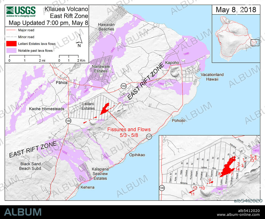
Map showing the fissures and lava flows from Kilauea's lower East Rift Zone eruption, as of 7:00 p.m. HST, May 8, 2018. Shaded purple areas indicate lava flows erupted in 1840, 1955, 1960, and 2014-2015. The 2018 lava flows are in red. Compare with the map from June 25 (SS21449783) to see how the lava flows have expanded and changed the coastline.
Crédit:
Album / Science Source / U.S. Geological Survey
Autorisations:
Modèle: Non - Propriété: Non
Questions sur les droits?
Questions sur les droits?
Taille de l'image:
3300 x 2550 px | 24.1 MB
Taille d'impression:
27.9 x 21.6 cm | 11.0 x 8.5 in (300 dpi)
Mots clés:
 Pinterest
 Twitter
 Facebook
 Copier le lien
 Email
Email
