alb5533484
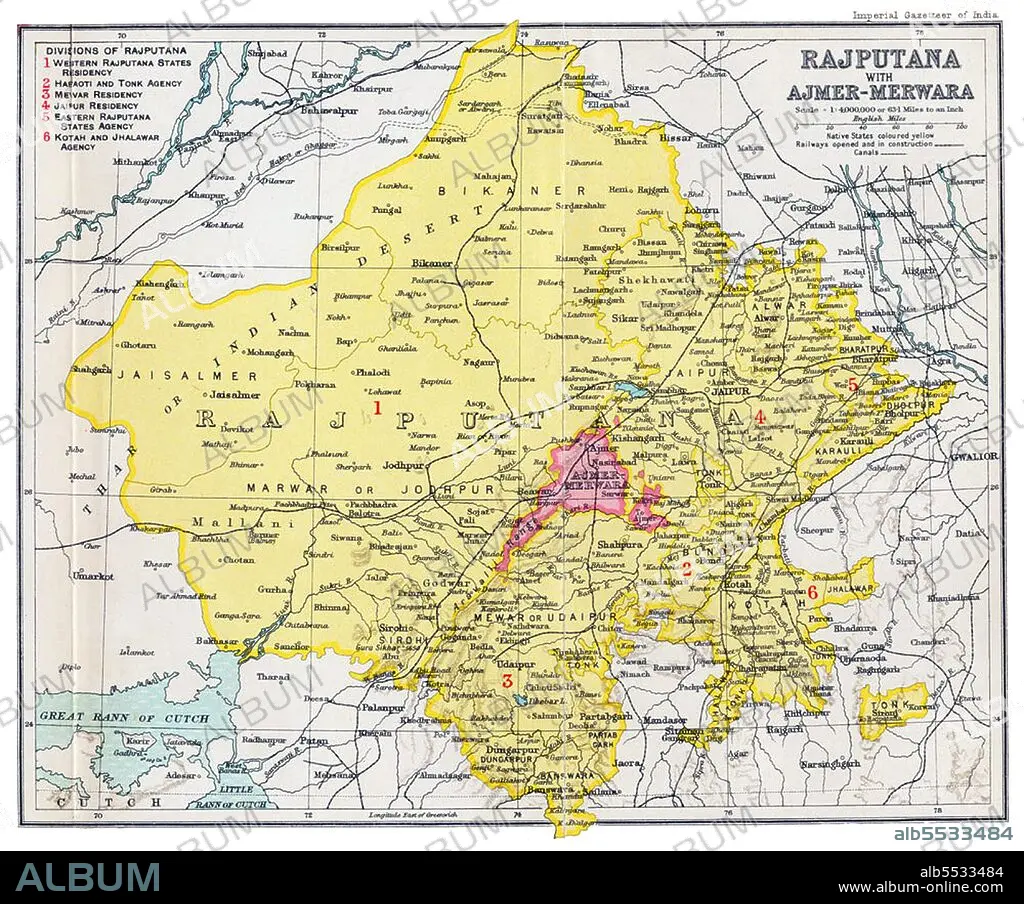
India: Imperial Gazetteer of India map of 'Rajputana with Ajmer-Merwara', Bartholomew,1909.
| Partager |
|---|
 Pinterest Pinterest |
 Twitter Twitter |
 Facebook Facebook |
 Copier le lien Copier le lien |
 Email Email |
|
Ajouter à une autre Lightbox |
|
Ajouter à une autre Lightbox |


Avez-vous déjà un compte? S'identifier
Vous n'avez pas de compte ? S'inscrire
Acheter cette image

Titre:
India: Imperial Gazetteer of India map of 'Rajputana with Ajmer-Merwara', Bartholomew,1909.
Légende:
Voir la traduction automatique
Rajputana (Hindi: ????????? ) was the name adopted by British government for its dependencies in the region of present-day Indian state of Rajasthan. Rajputana included 18 princely states, two chiefships and the British district of Ajmer-Merwara. This British official term remained official till its replacement by Rajasthan in the constitution of 1949.
Crédit:
Album / David Henley/Pictures from History/Universal Images Group
Autorisations:
Modèle: Non - Propriété: Non
Questions sur les droits?
Questions sur les droits?
Taille de l'image:
4500 x 3740 px | 48.2 MB
Taille d'impression:
38.1 x 31.7 cm | 15.0 x 12.5 in (300 dpi)
Mots clés:
ASIE • ASIE, CONTINENT • CARTE (GEOGRAPHIE) • CARTE GEOGRAPHIQUE • CARTE • CARTOGRAPHIE • COLONIALISME • CONTINENT ASIE • DESSIN PLANS • HISOIRE • HISTOIRE • IMPERIALISME • INDE • INDES • INDIEN • INDIENNE • INDIENS • PLAN (CARTOGRAPHIE) • PLANS • SCIENCE: CARTOGRAPHIE
