alb4529017
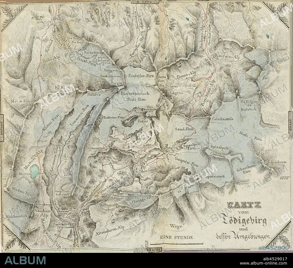
Map of the Tödigebirg and its surroundings, Map of Tödi and surroundings, plate 1, before S. 1, Hegetschweiler, Johannes, 1825, Johannes Hegetschweiler, Reisen in den Gebirgsstock zwischen Glarus und Graubünden in den Jahren 1819, 1820 und 1822. Zürich: Orell, Füssli und Compagnie, 1825.
| Partager |
|---|
 Pinterest Pinterest |
 Twitter Twitter |
 Facebook Facebook |
 Copier le lien Copier le lien |
 Email Email |
|
Ajouter à une autre Lightbox |
|
Ajouter à une autre Lightbox |


Avez-vous déjà un compte? S'identifier
Vous n'avez pas de compte ? S'inscrire
Acheter cette image.
Sélectionnez l'usage:

Légende:
Voir la traduction automatique
Map of the Tödigebirg and its surroundings, Map of Tödi and surroundings, plate 1, before S. 1, Hegetschweiler, Johannes, 1825, Johannes Hegetschweiler, Reisen in den Gebirgsstock zwischen Glarus und Graubünden in den Jahren 1819, 1820 und 1822. Zürich: Orell, Füssli und Compagnie, 1825
Crédit:
Album / quintlox
Autorisations:
Taille de l'image:
3641 x 3150 px | 32.8 MB
Taille d'impression:
30.8 x 26.7 cm | 12.1 x 10.5 in (300 dpi)
Mots clés:
