alb4062946
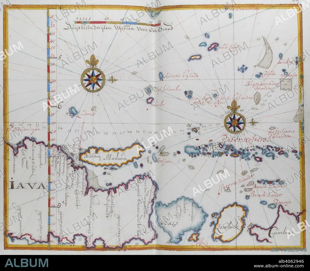
Map of the Islands of Java; Madura; Bali and other islands. DUTCH PORTOLANO, containing forty-nine coloured maps and views. 17th century. Source: Add. 34184, f.58.
| Partager |
|---|
 Pinterest Pinterest |
 Twitter Twitter |
 Facebook Facebook |
 Copier le lien Copier le lien |
 Email Email |
|
Ajouter à une autre Lightbox |
|
Ajouter à une autre Lightbox |


Avez-vous déjà un compte? S'identifier
Vous n'avez pas de compte ? S'inscrire
Acheter cette image.
Sélectionnez l'usage:

Légende:
Voir la traduction automatique
Map of the Islands of Java; Madura; Bali and other islands. DUTCH PORTOLANO, containing forty-nine coloured maps and views. 17th century. Source: Add. 34184, f.58.
Crédit:
Album / British Library
Autorisations:
Modèle: Non - Propriété: Non
Questions sur les droits?
Questions sur les droits?
Taille de l'image:
4747 x 3905 px | 53.0 MB
Taille d'impression:
40.2 x 33.1 cm | 15.8 x 13.0 in (300 dpi)
Mots clés:
17E SIECLE • 17EME S • ART POPULAIRE INDONESIEN • ASIE • ASIE, CONTINENT • CARTE (GEOGRAPHIE) • CARTE GEOGRAPHIQUE • CARTE • CARTOGRAPHIE • CONTINENT ASIE • COULEUR • COULEURS • DESSIN PLANS • DIX-SEPTIÈME SIÈCLE • INDONESIE • JAVA • PLAN (CARTOGRAPHIE) • PLANS • SCIENCE: CARTOGRAPHIE • XVIIE SIECLE
