alb2603576
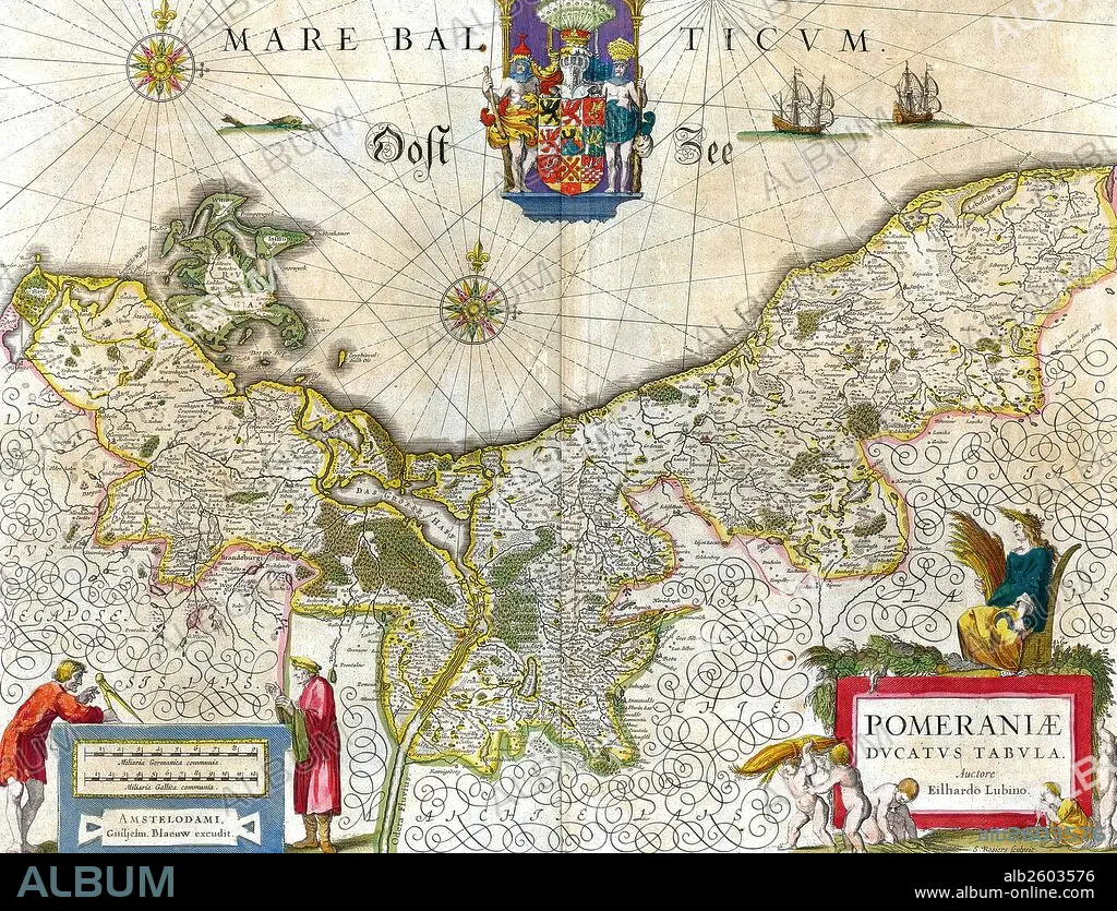
Map of the historical Duchy of Pomerania.
| Partager |
|---|
 Pinterest Pinterest |
 Twitter Twitter |
 Facebook Facebook |
 Copier le lien Copier le lien |
 Email Email |
|
Ajouter à une autre Lightbox |
|
Ajouter à une autre Lightbox |


Avez-vous déjà un compte? S'identifier
Vous n'avez pas de compte ? S'inscrire
Acheter cette image.
Sélectionnez l'usage:

Titre: Map of the historical Duchy of Pomerania.
Légende: Voir la traduction automatique
Map of the historical Duchy of Pomerania. The Duchy of Pomerania 12th century – 1637 was a duchy in Pomerania on the southern coast of the Baltic Sea, ruled by dukes of the House of Pomerania (Griffins). Dated 1635.
Map of the historical Duchy of Pomerania. The Duchy of Pomerania 12th century – 1637 was a duchy in Pomerania on the southern coast of the Baltic Sea, ruled by dukes of the House of Pomerania (Griffins). Dated 1635.
Crédit: Album / Universal Images Group / Universal History Archive
Autorisations: ? Autorisation de modèle: Non - ? Autorisation de propriété: Non
Questions sur les droits?
Questions sur les droits?
Taille de l'image: 5100 × 3893 px | 56.8 MB
Taille d'impression: 43.2 × 33.0 cm | 2007.9 × 1532.7 in (300 dpi)
Mots clés: 17E SIECLE • 17EME S • ALLEMAGNE • APRES-GUERRE: POLOGNE • CARTE (GEOGRAPHIE) • CARTE GEOGRAPHIQUE • CARTE • COMMUNISME: POLOGNE • DESSIN PLANS • DIX-SEPTIÈME SIÈCLE • PLAN (CARTOGRAPHIE) • PLANS • POLOGNE • POLOGNE, COMMUNISME • XVIIE SIECLE
