alb2590714
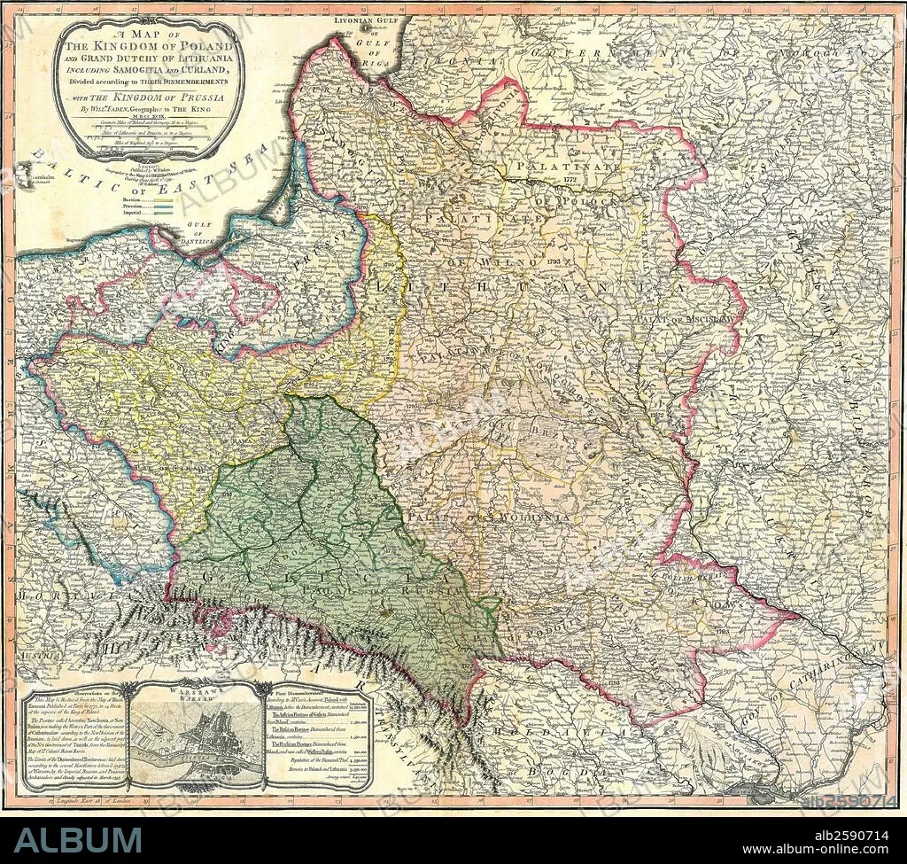
Map of the Partition of the Kingdom of Poland and the Grand Duchy of Lithuania.
| Partager |
|---|
 Pinterest Pinterest |
 Twitter Twitter |
 Facebook Facebook |
 Copier le lien Copier le lien |
 Email Email |
|
Ajouter à une autre Lightbox |
|
Ajouter à une autre Lightbox |


Avez-vous déjà un compte? S'identifier
Vous n'avez pas de compte ? S'inscrire
Acheter cette image.
Sélectionnez l'usage:

Titre: Map of the Partition of the Kingdom of Poland and the Grand Duchy of Lithuania.
Légende: Voir la traduction automatique
Map of the Partition of the Kingdom of Poland and the Grand Duchy of Lithuania. Dated 1799
Map of the Partition of the Kingdom of Poland and the Grand Duchy of Lithuania. Dated 1799
Crédit: Album / Universal Images Group / Universal History Archive/UIG
Autorisations: ? Autorisation de modèle: Non - ? Autorisation de propriété: Non
Questions sur les droits?
Questions sur les droits?
Taille de l'image: 4827 × 4344 px | 60.0 MB
Taille d'impression: 40.9 × 36.8 cm | 1900.4 × 1710.2 in (300 dpi)
Mots clés: 18 18E 18EME XVIII XVIIIE XVIIIEME SIECLE • 18E SIECLE • 18EME S • APRES-GUERRE: POLOGNE • CARTE (GEOGRAPHIE) • CARTE GEOGRAPHIQUE • CARTE • COMMUNISME: POLOGNE • DESSIN PLANS • DIX-HUITIÈME SIÈCLE • LITUANIE • PLAN (CARTOGRAPHIE) • PLANS • POLOGNE • POLOGNE, COMMUNISME • ROYAUME • ROYAUTÉ • XVIIIE SIECLE
