alb4088250
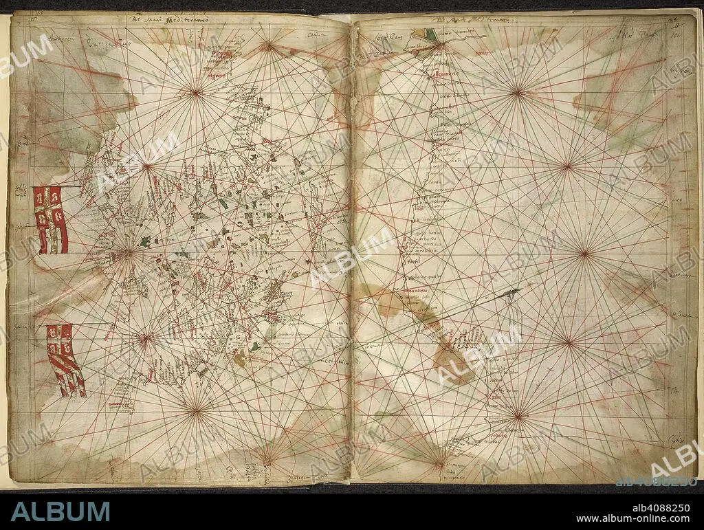
PIETRO VESCONTE. Portolan chart of the Eastern Mediterranean, with Greece, Turkey, the Black Sea, and Crete. Maps of the Liber Secretorum Fidelium Crucis. Italy (Venice); circa 1320-1325. Source: Add. 27376*, ff.183v-184. Language: Latin.
| Partager |
|---|
 Pinterest Pinterest |
 Twitter Twitter |
 Facebook Facebook |
 Copier le lien Copier le lien |
 Email Email |
|
Ajouter à une autre Lightbox |
|
Ajouter à une autre Lightbox |


Avez-vous déjà un compte? S'identifier
Vous n'avez pas de compte ? S'inscrire
Acheter cette image.
Sélectionnez l'usage:

Auteur: PIETRO VESCONTE
Légende: Voir la traduction automatique
Portolan chart of the Eastern Mediterranean, with Greece, Turkey, the Black Sea, and Crete. Maps of the Liber Secretorum Fidelium Crucis. Italy (Venice); circa 1320-1325. Source: Add. 27376*, ff.183v-184. Language: Latin.
Portolan chart of the Eastern Mediterranean, with Greece, Turkey, the Black Sea, and Crete. Maps of the Liber Secretorum Fidelium Crucis. Italy (Venice); circa 1320-1325. Source: Add. 27376*, ff.183v-184. Language: Latin.
Crédit: Album / British Library
Autorisations: ? Autorisation de modèle: Non - ? Autorisation de propriété: Non
Questions sur les droits?
Questions sur les droits?
Taille de l'image: 6846 × 4798 px | 94.0 MB
Taille d'impression: 58.0 × 40.6 cm | 2695.3 × 1889.0 in (300 dpi)
Mots clés: 14 14E 14EME XIV XIVE XIVEME SIECLE • 14E SIECLE • 14EME S • BALKA • BALKAN • CARTE (GEOGRAPHIE) • CARTE GEOGRAPHIQUE • CARTE • CARTOGRAPHIE • COULEUR • COULEURS • DESSIN PLANS • DOCUMENT • EUROPE • GRECE • MÉDITERRANÉE • PIETRO VESCONTE • PLAN (CARTOGRAPHIE) • PLANS • QUATORZIÈME SIÈCLE • SCIENCE: CARTOGRAPHIE • TURQUIE • XIVE SIECLE
