alb1657672
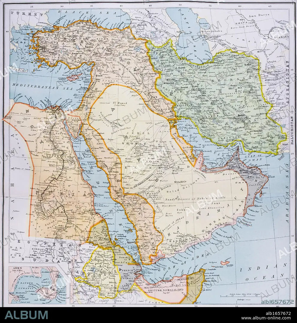
Map of Turkey Middle East Horn of Africa and Persian Gulf in 1890s From The Citizen's Atlas of the World published London circa 1899.
| Partager |
|---|
 Pinterest Pinterest |
 Twitter Twitter |
 Facebook Facebook |
 Copier le lien Copier le lien |
 Email Email |
|
Ajouter à une autre Lightbox |
|
Ajouter à une autre Lightbox |


Avez-vous déjà un compte? S'identifier
Vous n'avez pas de compte ? S'inscrire
Acheter cette image

Légende:
Voir la traduction automatique
Map of Turkey Middle East Horn of Africa and Persian Gulf in 1890s From The Citizen's Atlas of the World published London circa 1899
Crédit:
Album / Universal History Archive/Universal Images Group
Autorisations:
Modèle: Non - Propriété: Non
Questions sur les droits?
Questions sur les droits?
Taille de l'image:
4341 x 4485 px | 55.7 MB
Taille d'impression:
36.8 x 38.0 cm | 14.5 x 14.9 in (300 dpi)
Mots clés:
AFRIQUE • ANT. OR.: IRAK • ANT. OR.: IRAN • ART PERSAN • CARTE (GEOGRAPHIE) • CARTE GEOGRAPHIQUE • CARTE • COULEUR • DESSIN PLANS • EGYPTE • EST • IRAK • IRAK, ANT. OR. • IRAN • IRAN, ANT. OR. • KEN • MER • MYTHES: PERSES • OCEAN • ORIENT • PAYSAGE MARITIME • PERSAN • PERSE • PERSES • PERSES, MYTHES • PLAN (CARTOGRAPHIE) • PLANS • ROUGE • TURQUIE • VERTICALE • XIXE SIÈCLE
