alb1960835
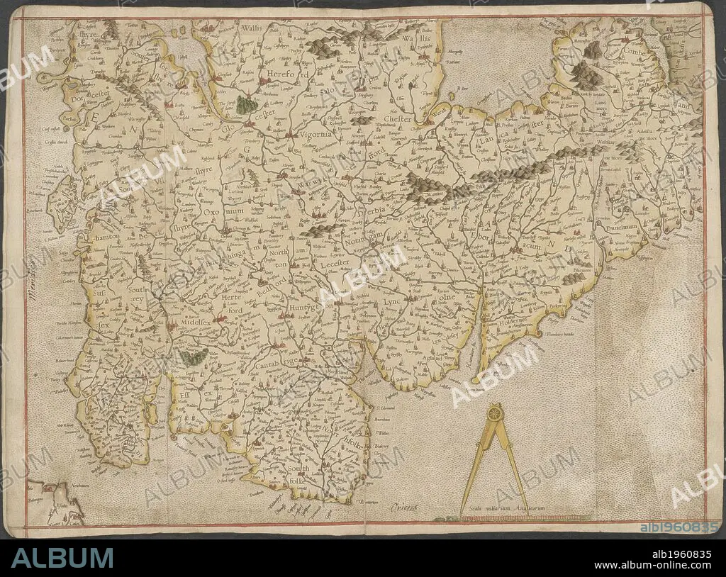
England. The Mercator atlas of Europe. 1570-1572. Map of England. Image taken from The Mercator atlas of Europe. Originally published/produced in 1570-1572. . Source: Maps.C.29.c.13.
| Partager |
|---|
 Pinterest Pinterest |
 Twitter Twitter |
 Facebook Facebook |
 Copier le lien Copier le lien |
 Email Email |
|
Ajouter à une autre Lightbox |
|
Ajouter à une autre Lightbox |


Avez-vous déjà un compte? S'identifier
Vous n'avez pas de compte ? S'inscrire
Acheter cette image.
Sélectionnez l'usage:

Légende:
Voir la traduction automatique
England. The Mercator atlas of Europe. 1570-1572. Map of England. Image taken from The Mercator atlas of Europe. Originally published/produced in 1570-1572. . Source: Maps.C.29.c.13.
Crédit:
Album / British Library
Autorisations:
Modèle: Non - Propriété: Non
Questions sur les droits?
Questions sur les droits?
Taille de l'image:
9509 x 7064 px | 192.2 MB
Taille d'impression:
80.5 x 59.8 cm | 31.7 x 23.5 in (300 dpi)
Mots clés:
16E SIECLE • 16EME S • ANGLETARRE • ANGLETERE • ANGLETERRE • CARTE (GEOGRAPHIE) • CARTE GEOGRAPHIQUE • CARTE • CARTOGRAPHIE • DESSIN PLANS • GRANDE BERTAGNE • GRANDE BRETAGNE • GRANDE-BRETAGNE • INGLATERRA • PLAN (CARTOGRAPHIE) • PLANS • ROYAUME UNI • ROYAUME-UNI • SCIENCE: CARTOGRAPHIE • SEIZIÈME SIÈCLE • XVIE SIECLE
