alb4190184
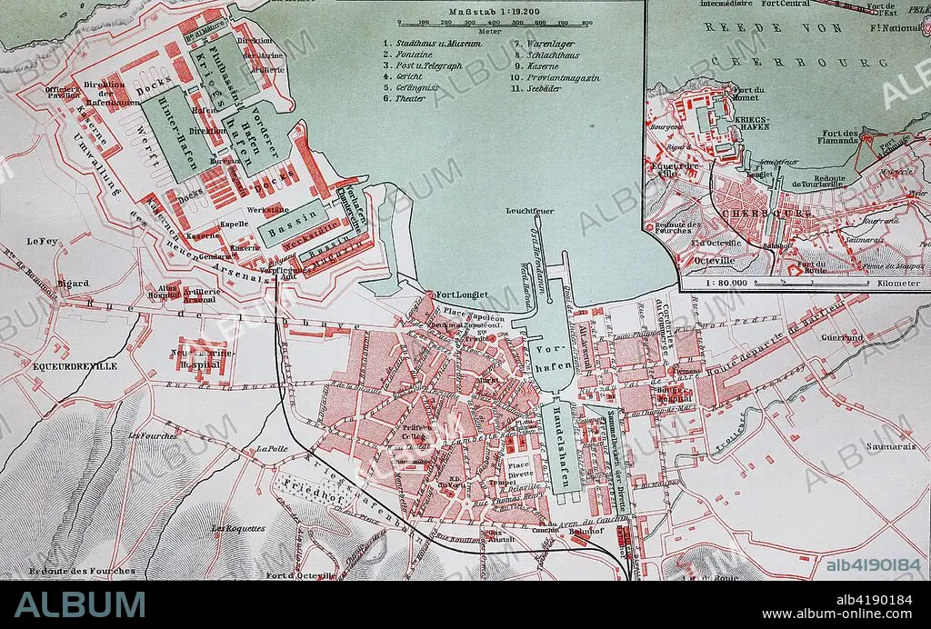
city map from the year 1892
| Partager |
|---|
 Pinterest Pinterest |
 Twitter Twitter |
 Facebook Facebook |
 Copier le lien Copier le lien |
 Email Email |
|
Ajouter à une autre Lightbox |
|
Ajouter à une autre Lightbox |


Avez-vous déjà un compte? S'identifier
Vous n'avez pas de compte ? S'inscrire
Acheter cette image.
Sélectionnez l'usage:

Titre:
city map from the year 1892
Légende:
Voir la traduction automatique
city map from the year 1892: Cherbourg, now Cherbourg-Octeville, France, digital improved reproduction of an original print from the year 1895
Crédit:
Album / Universal Images Group / Bildagentur/UIG
Autorisations:
Taille de l'image:
4064 x 2536 px | 29.5 MB
Taille d'impression:
34.4 x 21.5 cm | 13.5 x 8.5 in (300 dpi)
Mots clés:
ANCIEN • ANTIQUE • CARTE (GEOGRAPHIE) • CARTE GEOGRAPHIQUE • CARTE ROUTIERE • CARTE • CHERBOURG • CITE • DESSIN PLANS • EMPREINTE • FRANCE • PLAN (CARTOGRAPHIE) • PLAN DE VILLE • PLANS • RUE • SYMBOLIQUE • VILE • VILLE
