alb3548509
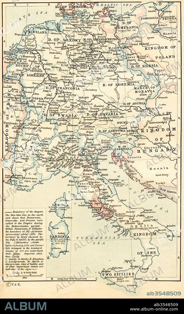
Map of The Holy Roman Empire under the Hohenstaufen, 1138-1254
| Partager |
|---|
 Pinterest Pinterest |
 Twitter Twitter |
 Facebook Facebook |
 Copier le lien Copier le lien |
 Email Email |
|
Ajouter à une autre Lightbox |
|
Ajouter à une autre Lightbox |


Avez-vous déjà un compte? S'identifier
Vous n'avez pas de compte ? S'inscrire
Acheter cette image.
Sélectionnez l'usage:

Titre:
Map of The Holy Roman Empire under the Hohenstaufen, 1138-1254
Légende:
Voir la traduction automatique
Map of The Holy Roman Empire under the Hohenstaufen, 1138 - 1254. From Historical Atlas, published 1923.
Crédit:
Album / Universal Images Group / Universal History Archive
Autorisations:
Taille de l'image:
3509 x 5677 px | 57.0 MB
Taille d'impression:
29.7 x 48.1 cm | 11.7 x 18.9 in (300 dpi)
Mots clés:
12E SIECLE • 12EME S • 13E SIECLE • 13EME S • ALLEMAND • ALLEMANDE • ART ROMAIN • CARTE (GEOGRAPHIE) • CARTE GEOGRAPHIQUE • CARTE • DESSIN PLANS • DOUZIÈME SIÈCLE • EPOQUE ROMAINE • GEOGRAPHIE • PAYS • PLAN (CARTOGRAPHIE) • PLANS • ROMAIN • TREIZIÈME SIÈCLE • XIIE SIECLE • XIIIE SIECLE
