alb3547870
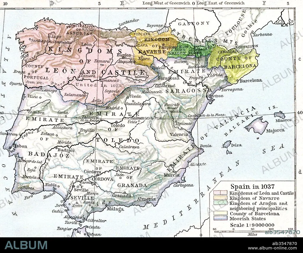
Map of Spain in 1037 showing the kingdoms of León and Castile, kingdom of Navarre, kingdom of Aragon and neighbouring principalities, county of Barcelona and Moorish states
| Partager |
|---|
 Pinterest Pinterest |
 Twitter Twitter |
 Facebook Facebook |
 Copier le lien Copier le lien |
 Email Email |
|
Ajouter à une autre Lightbox |
|
Ajouter à une autre Lightbox |


Avez-vous déjà un compte? S'identifier
Vous n'avez pas de compte ? S'inscrire
Acheter cette image.
Sélectionnez l'usage:

Titre:
Map of Spain in 1037 showing the kingdoms of León and Castile, kingdom of Navarre, kingdom of Aragon and neighbouring principalities, county of Barcelona and Moorish states
Légende:
Voir la traduction automatique
Map of Spain in 1037 showing the kingdoms of León and Castile, kingdom of Navarre, kingdom of Aragon and neighbouring principalities, county of Barcelona and Moorish states. From Historical Atlas, published 1923.
Crédit:
Album / Universal Images Group / Universal History Archive
Autorisations:
Taille de l'image:
4843 x 3797 px | 52.6 MB
Taille d'impression:
41.0 x 32.1 cm | 16.1 x 12.7 in (300 dpi)
Mots clés:
11E SIECLE • 11EME S • BARCELONE • CARTE (GEOGRAPHIE) • CARTE GEOGRAPHIQUE • CARTE • DESSIN PLANS • ESPAGNE • ESPAGNOL • GEOGRAPHIE • HISOIRE • HISTOIRE • ONZIÈME SIÈCLE • PAYS • PLAN (CARTOGRAPHIE) • PLANS • ROYAUME • ROYAUTÉ • XIE SIECLE
