alb5413004
Gerardus Mercator, Flemish Cartographer
| Partager |
|---|
 Pinterest Pinterest |
 Twitter Twitter |
 Facebook Facebook |
 Copier le lien Copier le lien |
 Email Email |
|
Ajouter à une autre Lightbox |
|
Ajouter à une autre Lightbox |


Avez-vous déjà un compte? S'identifier
Vous n'avez pas de compte ? S'inscrire
Acheter cette image.
Sélectionnez l'usage:

Titre: Gerardus Mercator, Flemish Cartographer
Légende: Voir la traduction automatique
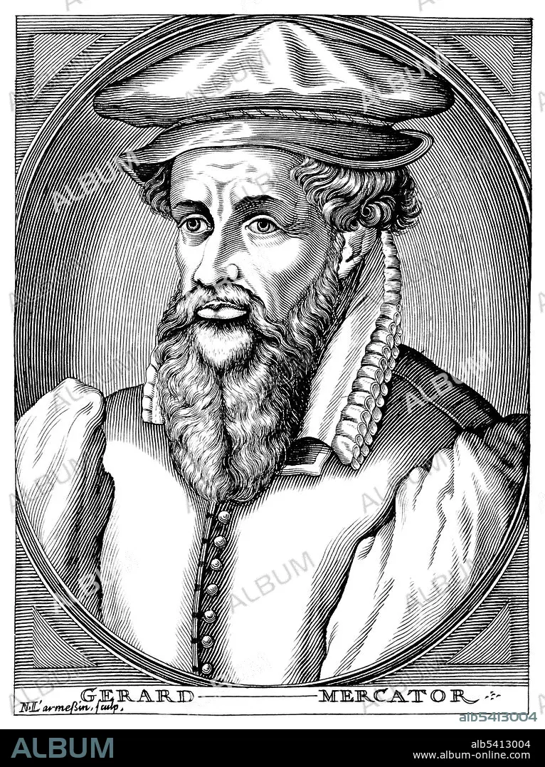
Gerardus Mercator (March 5, 1512 - December 2, 1594) was a Flemish cartographer. His map-making began when he produced a map of Palestine in 1537. In 1538 he produced a map of the world. In 1564 he was appointed Court Cosmographer to Wilhelm, Duke of Jülich-Cleves-Berg. In 1569 he constructed a new chart, the Mercator projection, a cylindrical map projection. It became the standard map projection for nautical purposes because of its ability to represent lines of constant course, known as rhumb lines or loxodromes, as straight segments. While the linear scale is equal in all directions around any point, thus preserving the angles and the shapes of small objects (which makes the projection conformal), the Mercator projection distorts the size and shape of large objects, as the scale increases from the Equator to the poles, where it becomes infinite. In 1570 Mercator took the word atlas to describe a collection of maps, and encouraged Abraham Ortelius to compile the first modern world atlas, Theatrum Orbis Terrarum. He produced his own atlas in a number of parts, the first of which was published in 1578. He died in 1594 at the age of 82. Line engraving by N. de Larmessin, 1682.
Gerardus Mercator (March 5, 1512 - December 2, 1594) was a Flemish cartographer. His map-making began when he produced a map of Palestine in 1537. In 1538 he produced a map of the world. In 1564 he was appointed Court Cosmographer to Wilhelm, Duke of Jülich-Cleves-Berg. In 1569 he constructed a new chart, the Mercator projection, a cylindrical map projection. It became the standard map projection for nautical purposes because of its ability to represent lines of constant course, known as rhumb lines or loxodromes, as straight segments. While the linear scale is equal in all directions around any point, thus preserving the angles and the shapes of small objects (which makes the projection conformal), the Mercator projection distorts the size and shape of large objects, as the scale increases from the Equator to the poles, where it becomes infinite. In 1570 Mercator took the word atlas to describe a collection of maps, and encouraged Abraham Ortelius to compile the first modern world atlas, Theatrum Orbis Terrarum. He produced his own atlas in a number of parts, the first of which was published in 1578. He died in 1594 at the age of 82. Line engraving by N. de Larmessin, 1682.
Crédit: Album / Science Source
Autorisations: ? Autorisation de modèle: Non - ? Autorisation de propriété: Non
Questions sur les droits?
Questions sur les droits?
Taille de l'image: 3254 × 4350 px | 40.5 MB
Taille d'impression: 27.6 × 36.8 cm | 1281.1 × 1712.6 in (300 dpi)
Mots clés: 16E SIECLE • 16EME S • CARTOGRAPHE • CÉLÈBRE • CELEBRITE • HOMME • SEIZIÈME SIÈCLE • XVIE SIECLE
