alb3897649
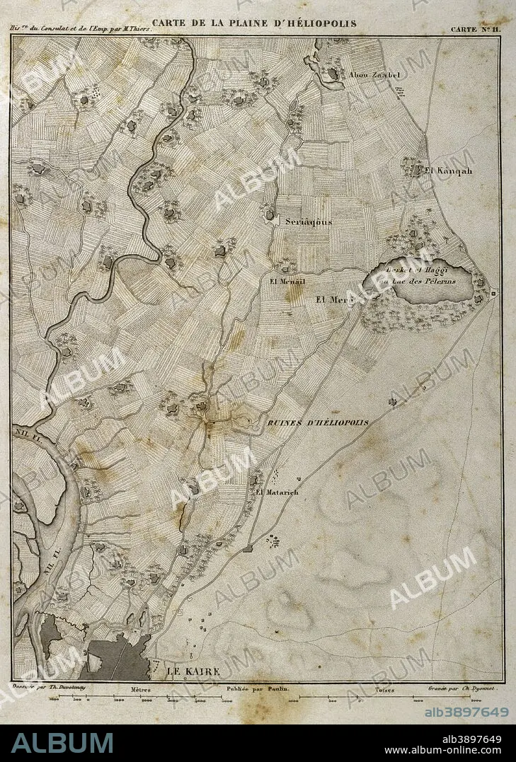
Map of Heliopolis (Egypt). On March 20, 1800, the Batlle of Heliopolis took place, with French victory, between France and the Ottoman Empire. Napoleonic campaign in Egypt. Atlas de l'Histoire du Consulat et de l'Empire. History of the Consulate and the Empire of France under Napoleon by Marie Joseph Louis Adolphe Thiers (1797-1877). Drawings by Dufour, engravings by Dyonnet. Edited in Paris, 1864.
| Partager |
|---|
 Pinterest Pinterest |
 Twitter Twitter |
 Facebook Facebook |
 Copier le lien Copier le lien |
 Email Email |
|
Ajouter à une autre Lightbox |
|
Ajouter à une autre Lightbox |


Avez-vous déjà un compte? S'identifier
Vous n'avez pas de compte ? S'inscrire
Acheter cette image.
Sélectionnez l'usage:

Légende: Voir la traduction automatique
Map of Heliopolis (Egypt). On March 20, 1800, the Batlle of Heliopolis took place, with French victory, between France and the Ottoman Empire. Napoleonic campaign in Egypt. Atlas de l'Histoire du Consulat et de l'Empire. History of the Consulate and the Empire of France under Napoleon by Marie Joseph Louis Adolphe Thiers (1797-1877). Drawings by Dufour, engravings by Dyonnet. Edited in Paris, 1864.
Map of Heliopolis (Egypt). On March 20, 1800, the Batlle of Heliopolis took place, with French victory, between France and the Ottoman Empire. Napoleonic campaign in Egypt. Atlas de l'Histoire du Consulat et de l'Empire. History of the Consulate and the Empire of France under Napoleon by Marie Joseph Louis Adolphe Thiers (1797-1877). Drawings by Dufour, engravings by Dyonnet. Edited in Paris, 1864.
Personnalités: NAPOLÉON IER (1769-1821)
Crédit: Album / Prisma
Autorisations: ? Autorisation de modèle: Non - ? Autorisation de propriété: Non
Questions sur les droits?
Questions sur les droits?
Taille de l'image: 3366 × 4730 px | 45.6 MB
Taille d'impression: 28.5 × 40.0 cm | 1325.2 × 1862.2 in (300 dpi)
Mots clés: ANCIEN • ANTIQUE • ARMEE • ARMÉEE • ARMÉES • BATAILLE • BATALLE • CAIRE • CAIRE, LE • CAMPAGNES NAPOLEONIENNES • CARTE (GEOGRAPHIE) • CARTE GEOGRAPHIQUE • CARTE • CARTOGRAPHIE • CHAMP BATAILLE • CHAMP DE BATAILLE • DESSIN PLANS • DESSIN • DESSINER • EMPIRE OTTOMAN • EUROPE • EUROPÉEN • FANCE • FLEUVE NIL • FLUVIALE • FRANCE • FRANÇAISE • FRAVURE • GEOGRAPHIE • GRAVURE • GUERRE NAPOLEONIENNES • GUERRES NAPOLEONIENNES • HELIOPOLIS • HISOIRE • HISTOIRE • HISTORIQUE • LA CAIRE • LE CAIRE • LE CAIRE, VUE • LECAIRE • MILITAIRE • MOTIF • NAPOLÉON IER • NAPOLEON, GUERRES • NIL • NIL, FLEUVE • PARIS • PARIS, FRANCE • PLAINE • PLAN (CARTOGRAPHIE) • PLANS • SCIENCE: CARTOGRAPHIE • TECHNIQUE: DESSIN • TERRITOIRE • THIERS • VIE MILITAIRE ET ARMEMENT • XIXE SIÈCLE
