alb4074047
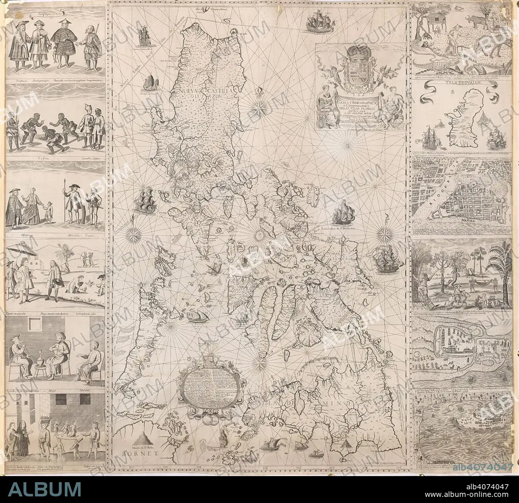
A map of the Philippine Islands with twelve marginal vignettes of illustrations of life in the Philippine Islands and plans of Guam, Cavite, Zamboanga and Manila . Carta Hydrographica, y Chorographica delas Yslas Filipinas. Manila, 1734. Source: Maps K.Top.116.37.
| Partager |
|---|
 Pinterest Pinterest |
 Twitter Twitter |
 Facebook Facebook |
 Copier le lien Copier le lien |
 Email Email |
|
Ajouter à une autre Lightbox |
|
Ajouter à une autre Lightbox |


Avez-vous déjà un compte? S'identifier
Vous n'avez pas de compte ? S'inscrire
Acheter cette image

Légende:
Voir la traduction automatique
A map of the Philippine Islands with twelve marginal vignettes of illustrations of life in the Philippine Islands and plans of Guam, Cavite, Zamboanga and Manila . Carta Hydrographica, y Chorographica delas Yslas Filipinas. Manila, 1734. Source: Maps K.Top.116.37.
Personnalités:
Crédit:
Album / British Library
Autorisations:
Modèle: Non - Propriété: Non
Questions sur les droits?
Questions sur les droits?
Taille de l'image:
4550 x 4170 px | 54.3 MB
Taille d'impression:
38.5 x 35.3 cm | 15.2 x 13.9 in (300 dpi)
Mots clés:
18 18E 18EME XVIII XVIIIE XVIIIEME SIECLE • 18E SIECLE • 18EME S • ARMOIRIES (NOBLESSE) • CARTE (GEOGRAPHIE) • CARTE GEOGRAPHIQUE • CARTE • CARTOGRAPHIE • DESSIN PLANS • DIX-HUITIÈME SIÈCLE • DOCUMENT • ILLUSTRATION • PHILIPPINES • PLAN (CARTOGRAPHIE) • PLAN • PLANS • SCIENCE: CARTOGRAPHIE • XVIIIE SIECLE
