alb2654798
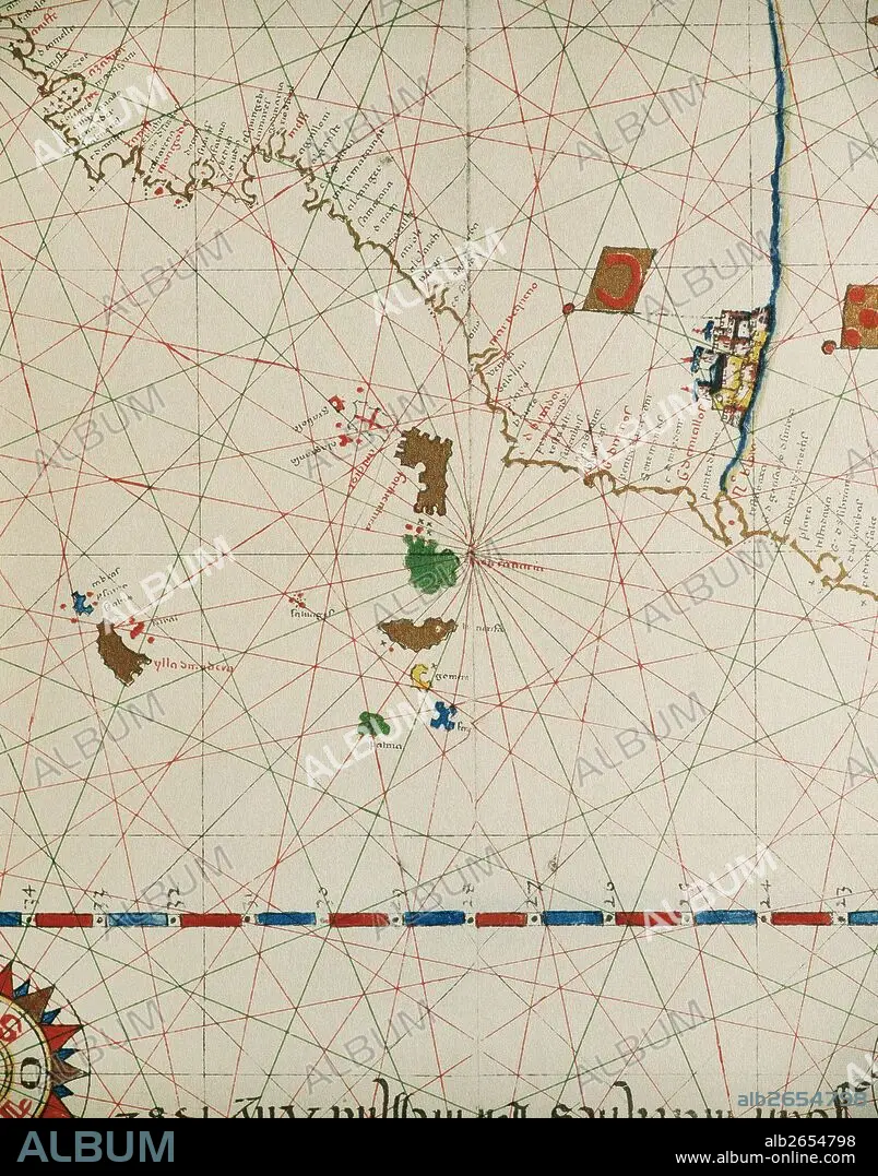
Portolan of Spanish cartographer Joan Martines (16th century). Majorcal school. 1587. Map of the Canary Islands and the west coast of Africa. Messina, Sicily. National Library. Madrid. Spain.
| Partager |
|---|
 Pinterest Pinterest |
 Twitter Twitter |
 Facebook Facebook |
 Copier le lien Copier le lien |
 Email Email |
|
Ajouter à une autre Lightbox |
|
Ajouter à une autre Lightbox |


Avez-vous déjà un compte? S'identifier
Vous n'avez pas de compte ? S'inscrire
Acheter cette image.
Sélectionnez l'usage:

Légende: Voir la traduction automatique
Portolan of Spanish cartographer Joan Martines (16th century). Majorcal school. 1587. Map of the Canary Islands and the west coast of Africa. Messina, Sicily. National Library. Madrid. Spain.
Portolan of Spanish cartographer Joan Martines (16th century). Majorcal school. 1587. Map of the Canary Islands and the west coast of Africa. Messina, Sicily. National Library. Madrid. Spain.
Crédit: Album / Prisma
Autorisations: ? Autorisation de modèle: Non - ? Autorisation de propriété: Non
Questions sur les droits?
Questions sur les droits?
Taille de l'image: 3991 × 5083 px | 58.0 MB
Taille d'impression: 33.8 × 43.0 cm | 1571.3 × 2001.2 in (300 dpi)
Mots clés: 16E SIECLE • 16EME S • AFRIQUE • AMÉRCAIN • AMÉRICAIN • AMÉRICAINE • AMÉRICIAN • AMÉRICIANE • AMERIQUE • AMERIQUE, CONTINENT • ART (CATÉGORIE) • ART • CARTE (GEOGRAPHIE) • CARTE GEOGRAPHIQUE • CARTE MARINE • CARTE • CARTOGRAPHE • CARTOGRAPHIE • CONTINENT AMERIQUE • CÔTE • DÉCOUVERTE • DESSIN PLANS • ESPAGNE • GEOGRAPHIE • HISOIRE • HISTOIRE • LITTORAL • MARITIME • OCEAN ATLANTIQUE • PLAN (CARTOGRAPHIE) • PLANS • PORTULAN • SCIENCE: CARTOGRAPHIE • SEIZIÈME SIÈCLE • SICILE • XVIE SIECLE
