alb3807497
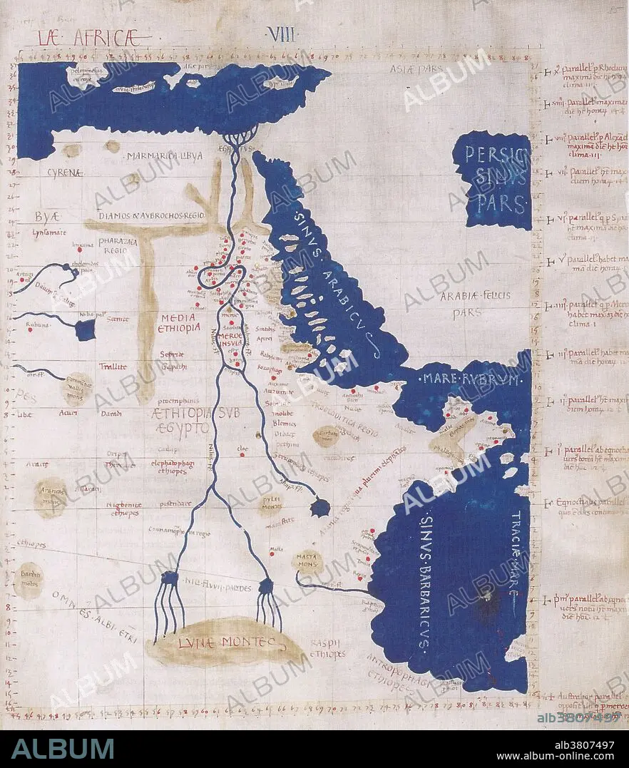
Ptolemy's Map of the Nile, 2nd Century
| Partager |
|---|
 Pinterest Pinterest |
 Twitter Twitter |
 Facebook Facebook |
 Copier le lien Copier le lien |
 Email Email |
|
Ajouter à une autre Lightbox |
|
Ajouter à une autre Lightbox |


Avez-vous déjà un compte? S'identifier
Vous n'avez pas de compte ? S'inscrire
Acheter cette image

Titre:
Ptolemy's Map of the Nile, 2nd Century
Légende:
Voir la traduction automatique
Ptolemy's map of the Nile was based on the description contained in Ptolemy's book Geographia, written 150 AD. Although authentic maps have never been found, the Geographia contains thousands of references to various parts of the old world, with coordinates for most, which allowed cartographers to reconstruct Ptolemy's world view when the manuscript was re-discovered around 1300 AD. Perhaps the most significant contribution of Ptolemy and his maps is the first uses of longitudinal and latitudinal lines and the specifying of terrestrial locations by celestial observations. When his Geographia was translated from Greek into Arabic in the 9th century and subsequently into Latin in Western Europe at the beginning of the 15th century, the idea of a global coordinate system revolutionized medieval Islamic and European geographical thinking and put it upon a scientific and numerical basis.
Crédit:
Album / Science Source / New York Public Library
Autorisations:
Modèle: Non - Propriété: Non
Questions sur les droits?
Questions sur les droits?
Taille de l'image:
3376 x 3918 px | 37.8 MB
Taille d'impression:
28.6 x 33.2 cm | 11.3 x 13.1 in (300 dpi)
Mots clés:
AFRIQUE • CARTE • CARTOGRAPHIE • CÉLÈBRE • CELEBRITE • FLEUVE NIL • GEOGRAPHIE • NIL • NIL, FLEUVE • SCIENCE: CARTOGRAPHIE • TOPOGRAPHIE
