alb4614684
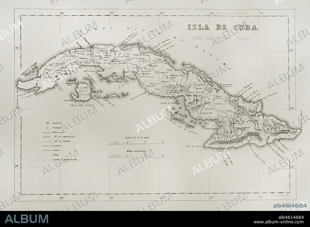
Map of the Island of Cuba (Spanish colonial period). Engraving. Crónica General de España, Historia Ilustrada y Descriptiva de sus Provincias (General Chronicle of Spain, Illustrated and Descriptive History of its Provinces), Antilles, 1871.
| Partager |
|---|
 Pinterest Pinterest |
 Twitter Twitter |
 Facebook Facebook |
 Copier le lien Copier le lien |
 Email Email |
|
Ajouter à une autre Lightbox |
|
Ajouter à une autre Lightbox |


Avez-vous déjà un compte? S'identifier
Vous n'avez pas de compte ? S'inscrire
Acheter cette image.
Sélectionnez l'usage:

Légende: Voir la traduction automatique
Map of the Island of Cuba (Spanish colonial period). Engraving. Crónica General de España, Historia Ilustrada y Descriptiva de sus Provincias (General Chronicle of Spain, Illustrated and Descriptive History of its Provinces), Antilles, 1871.
Map of the Island of Cuba (Spanish colonial period). Engraving. Crónica General de España, Historia Ilustrada y Descriptiva de sus Provincias (General Chronicle of Spain, Illustrated and Descriptive History of its Provinces), Antilles, 1871.
Emplacement: Collection privée
Crédit: Album / Prisma
Autorisations: ? Autorisation de modèle: Non - ? Autorisation de propriété: Non
Questions sur les droits?
Questions sur les droits?
Taille de l'image: 4724 × 3211 px | 43.4 MB
Taille d'impression: 40.0 × 27.2 cm | 1859.8 × 1264.2 in (300 dpi)
Mots clés: ARCHIPEL • CARAIBE • CARAIBES • CARTE (GEOGRAPHIE) • CARTE GEOGRAPHIQUE • CARTE • CARTOGRAPHIE • COLLECTION PRIVÉE • COLONIALISME • CUBA • DESSIN PLANS • ESPAGNOL • FRAVURE • GEOGRAPHIE • GRAVURE • HISOIRE • HISTOIRE • ILE • ÎLES • LA HAVANE • MER DES CARAIBES • PLAN (CARTOGRAPHIE) • PLANS • PROVINCE • PROVINS • SCIENCE: CARTOGRAPHIE • TERRITOIRE D'OUTRE-MER • TERRITOIRE • XIXE SIÈCLE
