alb9613441
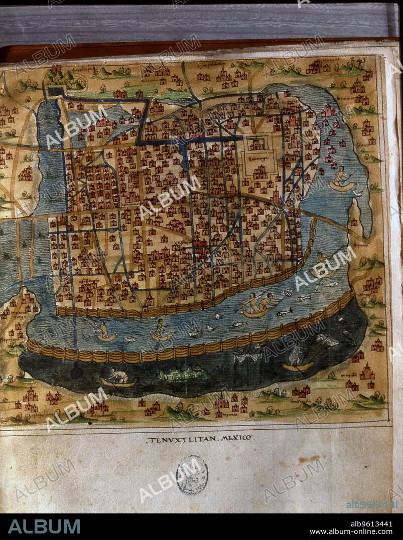
Map of Tenochtitlan, Mexico, 1560, in the work 'General Islands of the World', by the chronicler …
| Partager |
|---|
 Pinterest Pinterest |
 Twitter Twitter |
 Facebook Facebook |
 Copier le lien Copier le lien |
 Email Email |
|
Ajouter à une autre Lightbox |
|
Ajouter à une autre Lightbox |


Avez-vous déjà un compte? S'identifier
Vous n'avez pas de compte ? S'inscrire
Acheter cette image.
Sélectionnez l'usage:

Titre: Map of Tenochtitlan, Mexico, 1560, in the work 'General Islands of the World', by the chronicler …
Légende: Voir la traduction automatique
Map of Tenochtitlan, Mexico, 1560, in the work 'General Islands of the World', by the chronicler and cosmographer Alonso de Santa Cruz.
Map of Tenochtitlan, Mexico, 1560, in the work 'General Islands of the World', by the chronicler and cosmographer Alonso de Santa Cruz.
Crédit: Album / Pere Rotger/Index/Heritage Images
Autorisations: ? Autorisation de modèle: Non - ? Autorisation de propriété: Non
Questions sur les droits?
Questions sur les droits?
Taille de l'image: 3885 × 4956 px | 55.1 MB
Taille d'impression: 32.9 × 42.0 cm | 1529.5 × 1951.2 in (300 dpi)
Mots clés: COSMOGRAPHE • COULEUR • DÉCOUVERTE • GÉNÉRAL CONFÉDÉRÉ • GENERAL • GÉNÉRAUX • GNERAL • ILE • ÎLES • MADRID • MEXICO • MEXIQUE • MONDE • VERTICALE
