alb4088783
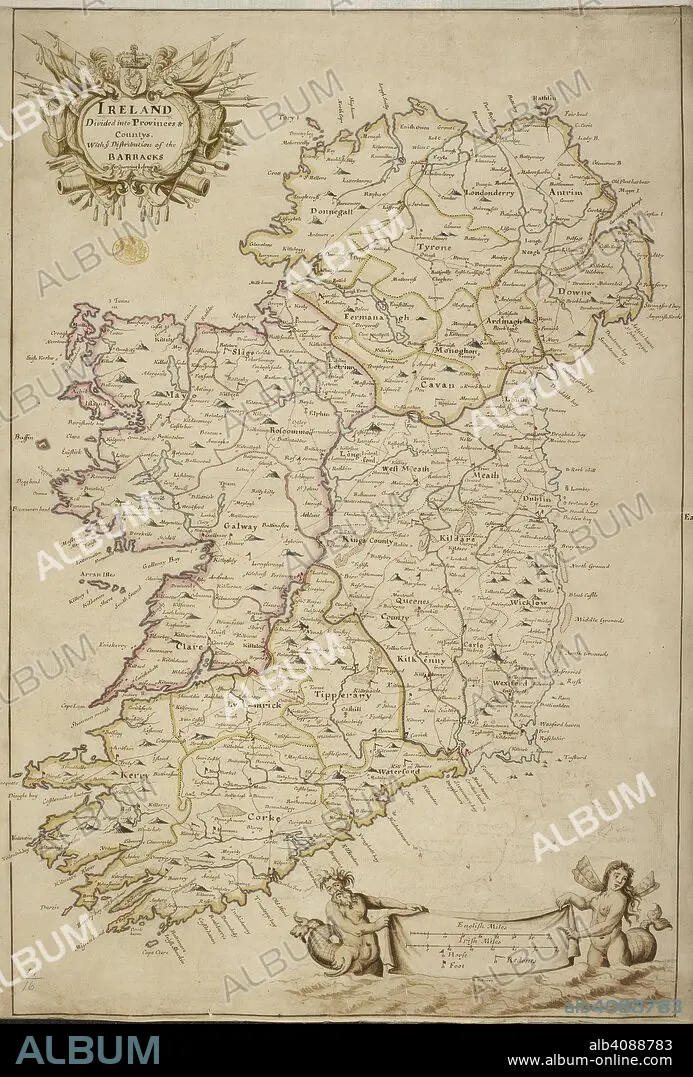
A map of Ireland divided into provinces and counties. A colored map of Ireland "divided into provinces and countys, with the distribution of the barracks for quartering the army". ca. 1700. Source: Maps K.Top.51.16. Language: English.
| Partager |
|---|
 Pinterest Pinterest |
 Twitter Twitter |
 Facebook Facebook |
 Copier le lien Copier le lien |
 Email Email |
|
Ajouter à une autre Lightbox |
|
Ajouter à une autre Lightbox |


Avez-vous déjà un compte? S'identifier
Vous n'avez pas de compte ? S'inscrire
Acheter cette image.
Sélectionnez l'usage:

Légende:
Voir la traduction automatique
A map of Ireland divided into provinces and counties. A colored map of Ireland "divided into provinces and countys, with the distribution of the barracks for quartering the army". ca. 1700. Source: Maps K.Top.51.16. Language: English.
Crédit:
Album / British Library
Autorisations:
Taille de l'image:
4518 x 6672 px | 86.2 MB
Taille d'impression:
38.3 x 56.5 cm | 15.1 x 22.2 in (300 dpi)
