alb5405734
Africa, Cape of Good Hope,1795
| Partager |
|---|
 Pinterest Pinterest |
 Twitter Twitter |
 Facebook Facebook |
 Copier le lien Copier le lien |
 Email Email |
|
Ajouter à une autre Lightbox |
|
Ajouter à une autre Lightbox |


Avez-vous déjà un compte? S'identifier
Vous n'avez pas de compte ? S'inscrire
Acheter cette image

Titre:
Africa, Cape of Good Hope,1795
Légende:
Voir la traduction automatique
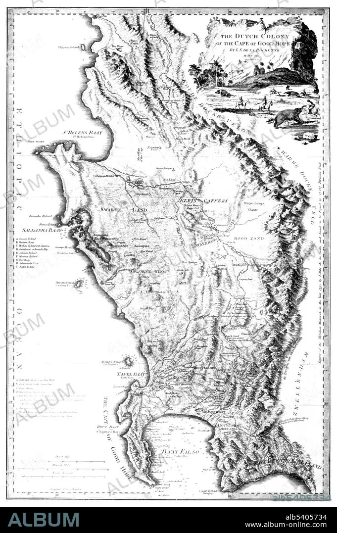
L.S. de la Rochette's map of the Cape of Good Hope. During the Napoleonic Wars, the Dutch Republic was occupied by the French in 1795. Thus the Cape Colony became a French vassal and enemy of the British. Therefore, the United Kingdom invaded and occupied the Cape Colony that same year. No biographical information can be found for Rochette. From William Faden's General Atlas, 1795. William Faden (1749 - 1836) was an English cartographer and a publisher of maps. He was the royal geographer to King George III.
Crédit:
Album / Science Source
Autorisations:
Modèle: Non - Propriété: Non
Questions sur les droits?
Questions sur les droits?
Taille de l'image:
3043 x 4575 px | 39.8 MB
Taille d'impression:
25.8 x 38.7 cm | 10.1 x 15.2 in (300 dpi)
Mots clés:
18 18E 18EME XVIII XVIIIE XVIIIEME SIECLE • 18E SIECLE • 18EME S • AFRIQUE • CAMPAGNES NAPOLEONIENNES • CARTE • CARTOGRAPHIE • CÉLÈBRE • CELEBRITE • DIX-HUITIÈME SIÈCLE • GEOGRAPHIE • GUERRE NAPOLEONIENNES • GUERRES NAPOLEONIENNES • ILLUSTRATION • NAPOLEON, GUERRES • SCIENCE: CARTOGRAPHIE • XVIIIE SIECLE
