alb12853337
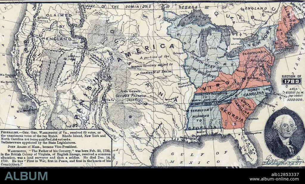
Political map of the USA in, 1789.
| Partager |
|---|
 Pinterest Pinterest |
 Twitter Twitter |
 Facebook Facebook |
 Copier le lien Copier le lien |
 Email Email |
|
Ajouter à une autre Lightbox |
|
Ajouter à une autre Lightbox |


Avez-vous déjà un compte? S'identifier
Vous n'avez pas de compte ? S'inscrire
Acheter cette image.
Sélectionnez l'usage:

Légende:
Voir la traduction automatique
Political map of the USA in, 1789.
Crédit:
Album / Universal History Archive/Universal Images Group
Autorisations:
Modèle: Non - Propriété: Non
Questions sur les droits?
Questions sur les droits?
Taille de l'image:
3720 x 2054 px | 21.9 MB
Taille d'impression:
31.5 x 17.4 cm | 12.4 x 6.8 in (300 dpi)
Mots clés:
AMERICAIN (ETATS-UNIS) • AMERICAIN (USA) • BASTILLE 1789 • CARTE HISTORIQUE • CONSTITUTION • ÉTAS UNIS • ÉTAS-UNIS • ETATS UNIS • ETATS-UNIS • FEDERALISME • FRANKLIN, BENJAMIN • INDEPENDANCE • JEFFERSON, THOMAS • OCEAN ATLANTIQUE • REVOLUTION FRANCAISE (1789-99) • REVOLUTION FRANCAISE 1789 • U. S. A. • WASHINGTON, GEORGE • ŽTATS-UNIS
