alb4201091
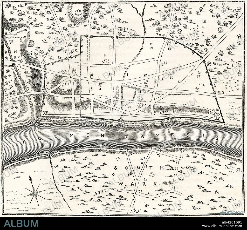
A plan of Roman London, known as Londinium, England. From Old England: A Pictorial Museum, published 1847.
| Partager |
|---|
 Pinterest Pinterest |
 Twitter Twitter |
 Facebook Facebook |
 Copier le lien Copier le lien |
 Email Email |
|
Ajouter à une autre Lightbox |
|
Ajouter à une autre Lightbox |


Avez-vous déjà un compte? S'identifier
Vous n'avez pas de compte ? S'inscrire
Acheter cette image.
Sélectionnez l'usage:

Légende: Voir la traduction automatique
A plan of Roman London, known as Londinium, England. From Old England: A Pictorial Museum, published 1847.
A plan of Roman London, known as Londinium, England. From Old England: A Pictorial Museum, published 1847.
Crédit: Album / Universal Images Group / Universal History Archive
Autorisations: ? Autorisation de modèle: Non - ? Autorisation de propriété: Non
Questions sur les droits?
Questions sur les droits?
Taille de l'image: 4971 × 4375 px | 62.2 MB
Taille d'impression: 42.1 × 37.0 cm | 1957.1 × 1722.4 in (300 dpi)
Mots clés: ANCIEN • ANGALIS • ANGLAIS • ANGLAISE • ANGLETARRE • ANGLETERE • ANGLETERRE • ANTIQUE • ARCHIVE • ART ROMAIN • CARTE (GEOGRAPHIE) • CARTE GEOGRAPHIQUE • CARTE • DESSIN PLANS • EPOQUE ROMAINE • FLEUVE TAMISE • GRANDE BERTAGNE • GRANDE BRETAGNE • GRANDE-BRETAGNE • HISOIRE • HISTOIRE • ILLUSTRATION • INGLATERRA • LONDRES • LONDRES, VUE SUR • LONDRES, VUE • PLAN (CARTOGRAPHIE) • PLANS • ROMAIN • ROYAUME UNI • ROYAUME-UNI • TAMISE • TAMISE, FLEUVE • VUE LONDRES
