alb5392360
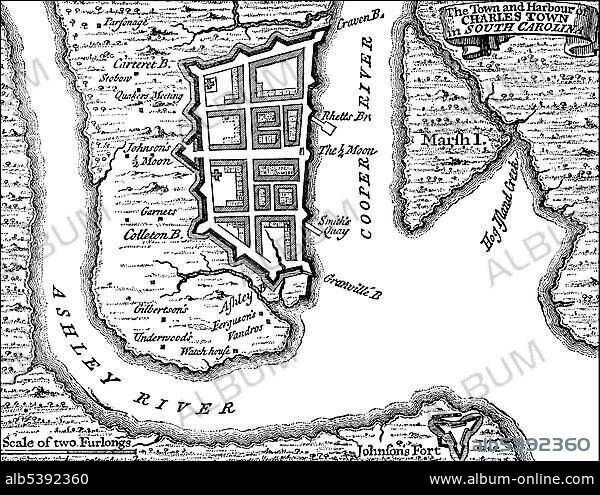
Historical drawing, US-American history, 18th century, map of Charlestown, Boston, Massachusetts, USA, 1780, North America.
| Partager |
|---|
 Pinterest Pinterest |
 Twitter Twitter |
 Facebook Facebook |
 Copier le lien Copier le lien |
 Email Email |
|
Ajouter à une autre Lightbox |
|
Ajouter à une autre Lightbox |


Avez-vous déjà un compte? S'identifier
Vous n'avez pas de compte ? S'inscrire
Acheter cette image.
Sélectionnez l'usage:

Légende:
Voir la traduction automatique
Historical drawing, US-American history, 18th century, map of Charlestown, Boston, Massachusetts, USA, 1780, North America
Crédit:
Album / ImageBroker / H.-D. Falkenstein
Autorisations:
Taille de l'image:
4762 x 3670 px | 50.0 MB
Taille d'impression:
40.3 x 31.1 cm | 15.9 x 12.2 in (300 dpi)
Mots clés:
