alb9831914
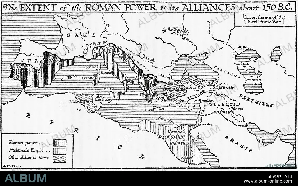
Map of the possible outline of Europe and Western Asia at the maximum of the fourth ice age. From A Short History of the World, published c.1936
| Partager |
|---|
 Pinterest Pinterest |
 Twitter Twitter |
 Facebook Facebook |
 Copier le lien Copier le lien |
 Email Email |
|
Ajouter à une autre Lightbox |
|
Ajouter à une autre Lightbox |


Avez-vous déjà un compte? S'identifier
Vous n'avez pas de compte ? S'inscrire
Acheter cette image.
Sélectionnez l'usage:

Légende:
Voir la traduction automatique
Map of the possible outline of Europe and Western Asia at the maximum of the fourth ice age. From A Short History of the World, published c.1936
Crédit:
Album / Ken Welsh/Universal History Archive/Universal Images Group
Autorisations:
Taille de l'image:
5790 x 3330 px | 55.2 MB
Taille d'impression:
49.0 x 28.2 cm | 19.3 x 11.1 in (300 dpi)
Mots clés:
ARCHIVE • CARTE (GEOGRAPHIE) • CARTE GEOGRAPHIQUE • CARTE • CARTOGRAPHIE • DESSIN PLANS • EMPIRE ROMAIN • EMPREINTE • FRAVURE • GEOGRAPHIE • GRAVURE • HISOIRE • HISTOIRE • ILLUSTRATION • MILLESIME • PAYS • PERIODE: ROME IMPERIALE • PLAN (CARTOGRAPHIE) • PLANS • ROME, IMPERIALE • SCIENCE: CARTOGRAPHIE
