alb4065584
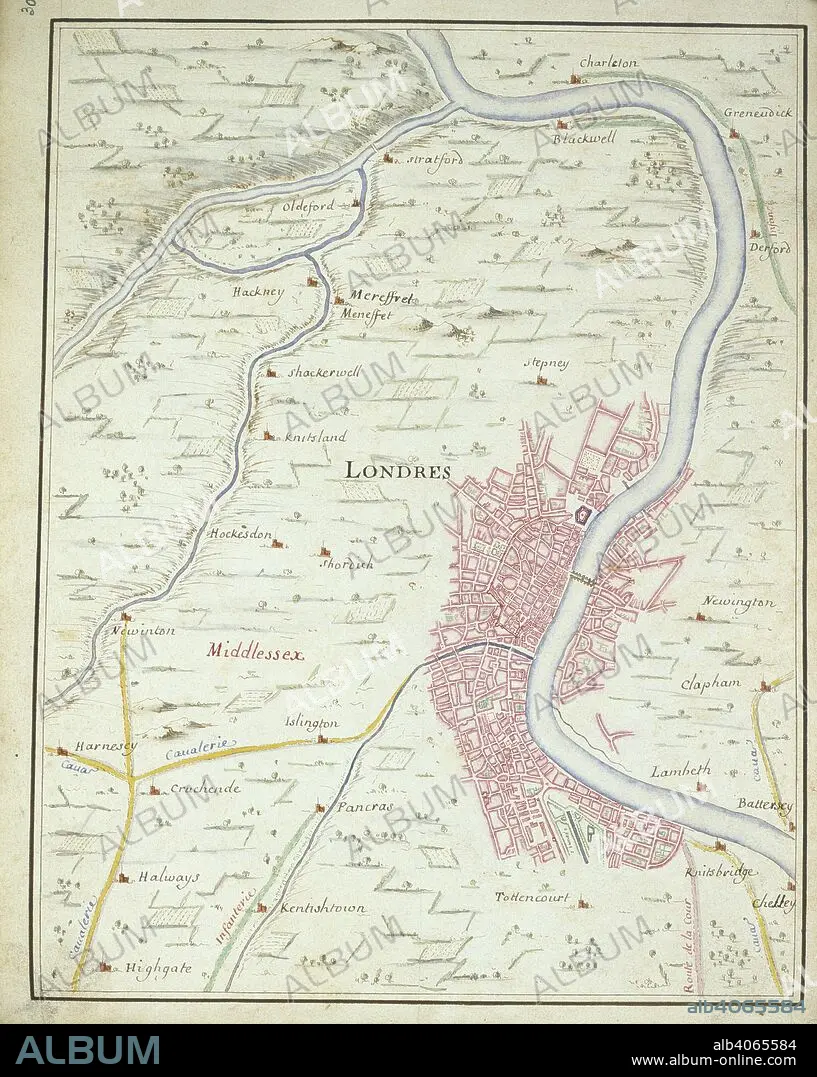
Map of London. Invasion of England by the Prince of Orange. 1688. (Whole map) Map of London, between Chelsea and Charlton; showing the route of William of Orange into London from Knightsbridge on the 28 December 1688 Image taken from Invasion of England by the Prince of Orange Originally published/produced in 1688. . Source: Add. 33970, f.30. Language: French.
| Partager |
|---|
 Pinterest Pinterest |
 Twitter Twitter |
 Facebook Facebook |
 Copier le lien Copier le lien |
 Email Email |
|
Ajouter à une autre Lightbox |
|
Ajouter à une autre Lightbox |


Avez-vous déjà un compte? S'identifier
Vous n'avez pas de compte ? S'inscrire
Acheter cette image

Légende:
Voir la traduction automatique
Map of London. Invasion of England by the Prince of Orange. 1688. (Whole map) Map of London, between Chelsea and Charlton; showing the route of William of Orange into London from Knightsbridge on the 28 December 1688 Image taken from Invasion of England by the Prince of Orange Originally published/produced in 1688. . Source: Add. 33970, f.30. Language: French.
Crédit:
Album / British Library
Autorisations:
Modèle: Non - Propriété: Non
Questions sur les droits?
Questions sur les droits?
Taille de l'image:
4065 x 5094 px | 59.2 MB
Taille d'impression:
34.4 x 43.1 cm | 13.6 x 17.0 in (300 dpi)
Mots clés:
ANGLETARRE • ANGLETERE • ANGLETERRE • CARTE (GEOGRAPHIE) • CARTE GEOGRAPHIQUE • CARTE • CARTOGRAPHIE • DESSIN PLANS • GRANDE BERTAGNE • GRANDE BRETAGNE • GRANDE-BRETAGNE • INGLATERRA • LONDRES • LONDRES, VUE SUR • LONDRES, VUE • PLAN (CARTOGRAPHIE) • PLANS • ROYAUME UNI • ROYAUME-UNI • SCIENCE: CARTOGRAPHIE • VUE LONDRES
