alb3546299
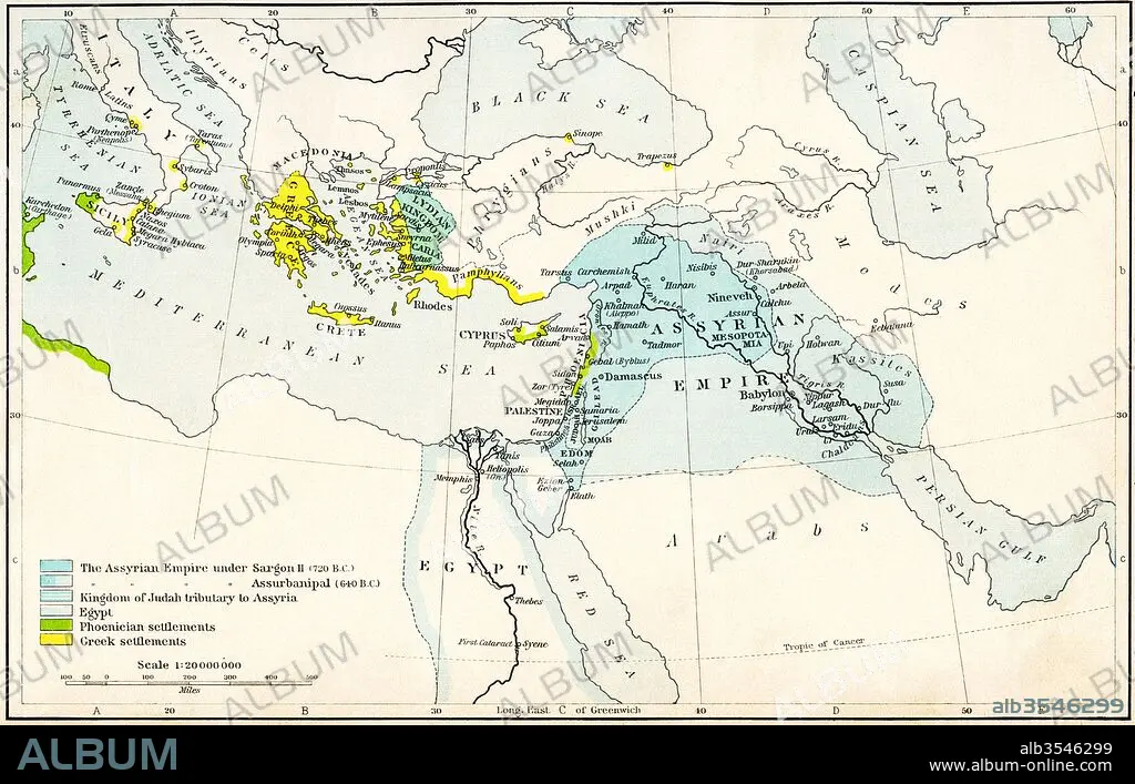
Map of the Assyrian Empire and the region around the eastern Mediterranean, 750-625 B
| Partager |
|---|
 Pinterest Pinterest |
 Twitter Twitter |
 Facebook Facebook |
 Copier le lien Copier le lien |
 Email Email |
|
Ajouter à une autre Lightbox |
|
Ajouter à une autre Lightbox |


Avez-vous déjà un compte? S'identifier
Vous n'avez pas de compte ? S'inscrire
Acheter cette image

Titre:
Map of the Assyrian Empire and the region around the eastern Mediterranean, 750-625 B
Légende:
Voir la traduction automatique
Map of the Assyrian Empire and the region around the eastern Mediterranean, 750 - 625 B.C. From Historical Atlas, published 1923.
Crédit:
Album / Universal Images Group / Universal History Archive
Autorisations:
Modèle: Non - Propriété: Non
Questions sur les droits?
Questions sur les droits?
Taille de l'image:
5362 x 3425 px | 52.5 MB
Taille d'impression:
45.4 x 29.0 cm | 17.9 x 11.4 in (300 dpi)
Mots clés:
ANCIEN • ANTIQUE • ASSYRIAN • CARTE (GEOGRAPHIE) • CARTE GEOGRAPHIQUE • CARTE • DESSIN PLANS • EASTERN • GEOGRAPHIE • PAYS • PLAN (CARTOGRAPHIE) • PLANS • TERROIR
