alb8363041
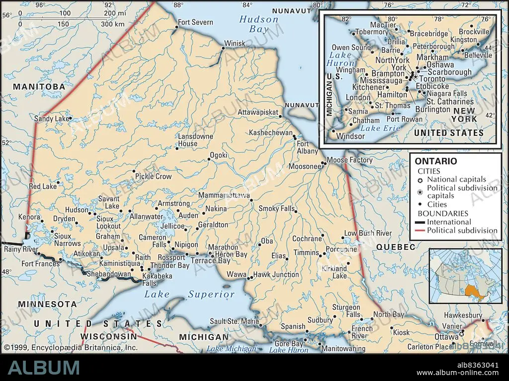
Political map of Ontario
| Partager |
|---|
 Pinterest Pinterest |
 Twitter Twitter |
 Facebook Facebook |
 Copier le lien Copier le lien |
 Email Email |
|
Ajouter à une autre Lightbox |
|
Ajouter à une autre Lightbox |


Avez-vous déjà un compte? S'identifier
Vous n'avez pas de compte ? S'inscrire
Acheter cette image.
Sélectionnez l'usage:

Légende:
Voir la traduction automatique
Political map of Ontario
Crédit:
Album / Universal Images Group / Encyclopaedia Britannica
Autorisations:
Modèle: Non - Propriété: Non
Questions sur les droits?
Questions sur les droits?
Taille de l'image:
3825 x 2672 px | 29.2 MB
Taille d'impression:
32.4 x 22.6 cm | 12.7 x 8.9 in (300 dpi)
Mots clés:
CANADA • CARTE (GEOGRAPHIE) • CARTE GEOGRAPHIQUE • CARTE • CARTOGRAPHIE • DESSIN PLANS • DETAIL • EXPLORATION • GEOGRAPHIE • HORIZONTALE • PLAN (CARTOGRAPHIE) • PLANS • PROVINCE • PROVINS • SCIENCE: CARTOGRAPHIE • XXE SIECLE
