alb5281072
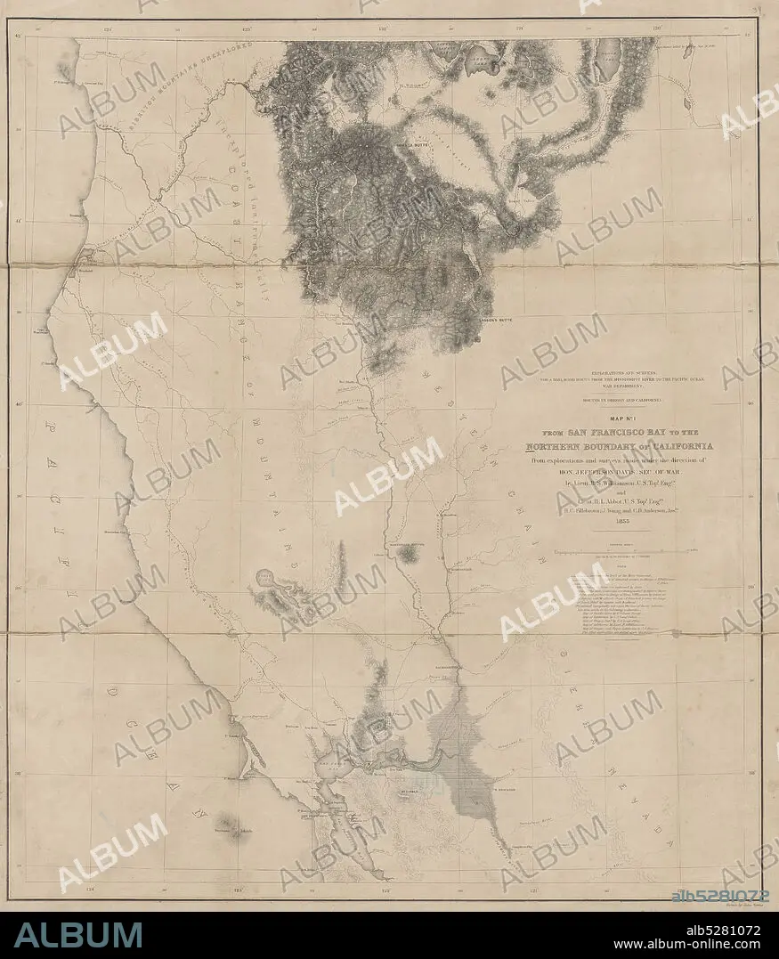
Map no. 1 from San Francisco Bay to the northern boundary of California , cartographic, Maps, 1855, Davis, Jefferson, 1808-1889, Williamson, R. S. (Robert Stockton), 1824-1882, Abbot, Henry L., Fillebrown, H. C., Anderson, C. D., Gibbs, George, 1815-1873.
| Partager |
|---|
 Pinterest Pinterest |
 Twitter Twitter |
 Facebook Facebook |
 Copier le lien Copier le lien |
 Email Email |
|
Ajouter à une autre Lightbox |
|
Ajouter à une autre Lightbox |


Avez-vous déjà un compte? S'identifier
Vous n'avez pas de compte ? S'inscrire
Acheter cette image.
Sélectionnez l'usage:

Légende:
Voir la traduction automatique
Map no. 1 from San Francisco Bay to the northern boundary of California , cartographic, Maps, 1855, Davis, Jefferson, 1808-1889, Williamson, R. S. (Robert Stockton), 1824-1882, Abbot, Henry L., Fillebrown, H. C., Anderson, C. D., Gibbs, George, 1815-1873
Personnalités:
Crédit:
Album / quintlox
Autorisations:
Modèle: Non - Propriété: Non
Questions sur les droits?
Questions sur les droits?
Taille de l'image:
5127 x 6000 px | 88.0 MB
Taille d'impression:
43.4 x 50.8 cm | 17.1 x 20.0 in (300 dpi)
Mots clés:
