alb9619961
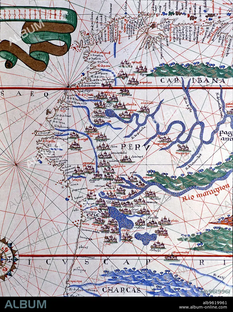
Atlas of Joan Martines, Messina, 1582. Portulan chart of the West Coast of America (Peru, Ecuador…
| Partager |
|---|
 Pinterest Pinterest |
 Twitter Twitter |
 Facebook Facebook |
 Copier le lien Copier le lien |
 Email Email |
|
Ajouter à une autre Lightbox |
|
Ajouter à une autre Lightbox |


Avez-vous déjà un compte? S'identifier
Vous n'avez pas de compte ? S'inscrire
Acheter cette image.
Sélectionnez l'usage:

Titre: Atlas of Joan Martines, Messina, 1582. Portulan chart of the West Coast of America (Peru, Ecuador…
Légende: Voir la traduction automatique
Atlas of Joan Martines, Messina, 1582. Portulan chart of the West Coast of America (Peru, Ecuador and Colombia).
Atlas of Joan Martines, Messina, 1582. Portulan chart of the West Coast of America (Peru, Ecuador and Colombia).
Crédit: Album / Mithra/Index/Heritage Images
Autorisations: ? Autorisation de modèle: Non - ? Autorisation de propriété: Non
Questions sur les droits?
Questions sur les droits?
Taille de l'image: 3930 × 5008 px | 56.3 MB
Taille d'impression: 33.3 × 42.4 cm | 1547.2 × 1971.7 in (300 dpi)
Mots clés: 16E SIECLE • 16EME S • CARTE • COULEUR • OUEST • PEROU • SEIZIÈME SIÈCLE • VERTICALE • XVIE SIECLE
