alb3546931
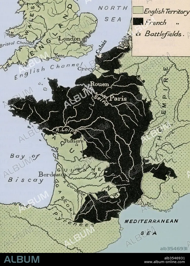
Map showing the English dominions in France after the Treaty of Calais in 1360
| Partager |
|---|
 Pinterest Pinterest |
 Twitter Twitter |
 Facebook Facebook |
 Copier le lien Copier le lien |
 Email Email |
|
Ajouter à une autre Lightbox |
|
Ajouter à une autre Lightbox |


Avez-vous déjà un compte? S'identifier
Vous n'avez pas de compte ? S'inscrire
Acheter cette image.
Sélectionnez l'usage:

Titre: Map showing the English dominions in France after the Treaty of Calais in 1360
Légende: Voir la traduction automatique
Map showing the English dominions in France after the Treaty of Calais in 1360. From A First Book of British History published 1925.
Map showing the English dominions in France after the Treaty of Calais in 1360. From A First Book of British History published 1925.
Crédit: Album / Universal Images Group / Universal History Archive
Autorisations: ? Autorisation de modèle: Non - ? Autorisation de propriété: Non
Questions sur les droits?
Questions sur les droits?
Taille de l'image: 3707 × 4930 px | 52.3 MB
Taille d'impression: 31.4 × 41.7 cm | 1459.4 × 1940.9 in (300 dpi)
Mots clés: 14 14E 14EME XIV XIVE XIVEME SIECLE • 14E SIECLE • 14EME S • ANGALIS • ANGLAIS • ANGLAISE • CALAIS • CARTE (GEOGRAPHIE) • CARTE GEOGRAPHIQUE • CARTE • DESSIN PLANS • ÉPOQUE • FRANCE • GEOGRAPHIE • HISOIRE • HISTOIRE • PAYS • PLAN (CARTOGRAPHIE) • PLANS • QUATORZIÈME SIÈCLE • XIVE SIECLE
