alb4070953
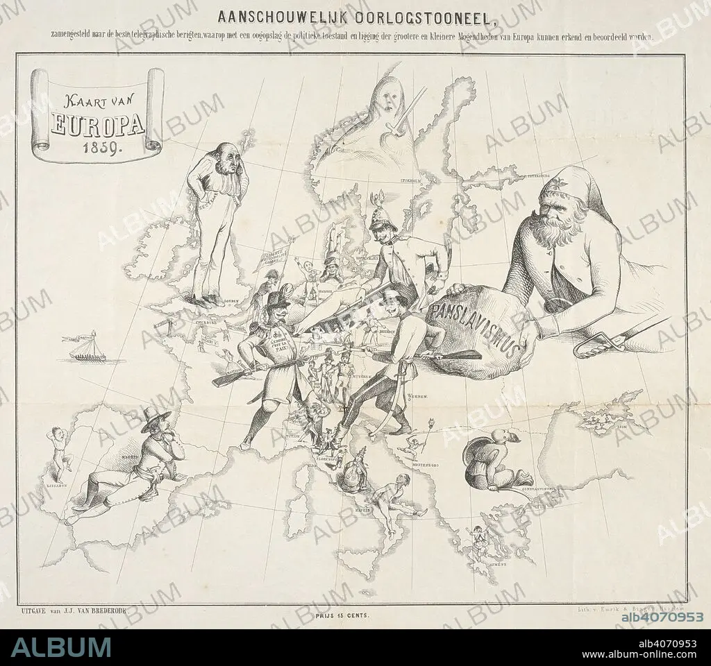
A Dutch cartoon map illustrating the political situation of Europe during the Franco-Austrian War. Kaart van Europa 1859. Haarlem : Emrik & Binger, 1859. Source: Maps CC.5.a.476. Language: Dutch.
| Partager |
|---|
 Pinterest Pinterest |
 Twitter Twitter |
 Facebook Facebook |
 Copier le lien Copier le lien |
 Email Email |
|
Ajouter à une autre Lightbox |
|
Ajouter à une autre Lightbox |


Avez-vous déjà un compte? S'identifier
Vous n'avez pas de compte ? S'inscrire
Acheter cette image

Légende:
Voir la traduction automatique
A Dutch cartoon map illustrating the political situation of Europe during the Franco-Austrian War. Kaart van Europa 1859. Haarlem : Emrik & Binger, 1859. Source: Maps CC.5.a.476. Language: Dutch.
Crédit:
Album / British Library
Autorisations:
Modèle: Non - Propriété: Non
Questions sur les droits?
Questions sur les droits?
Taille de l'image:
5017 x 4446 px | 63.8 MB
Taille d'impression:
42.5 x 37.6 cm | 16.7 x 14.8 in (300 dpi)
Mots clés:
ARMEE: SOLDATS • CARICATURE • CARICATURES • CARRICATURE • CARTE (GEOGRAPHIE) • CARTE GEOGRAPHIQUE • CARTE • CARTOGRAPHIE • CURIEUX • CURIOSITE • DESSIN PLANS • EUROPE • GUERRE • PLAN (CARTOGRAPHIE) • PLANS • SCIENCE: CARTOGRAPHIE • SENTIMENT: CURIOSITE • SOLDAT DE L'ARMEE POPULAIRE NATIONALE • SOLDAT • XIXE SIÈCLE
