alb5364408
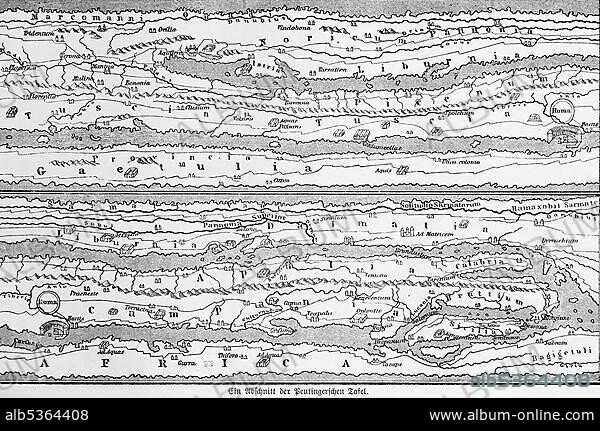
A section from the cartographic representation of the Peutinger's Table (Tabula Peutingeriana), UNESCO World Document Heritage, historical world map, illustration from 1881.
| Partager |
|---|
 Pinterest Pinterest |
 Twitter Twitter |
 Facebook Facebook |
 Copier le lien Copier le lien |
 Email Email |
|
Ajouter à une autre Lightbox |
|
Ajouter à une autre Lightbox |


Avez-vous déjà un compte? S'identifier
Vous n'avez pas de compte ? S'inscrire
Acheter cette image.
Sélectionnez l'usage:

Légende:
Voir la traduction automatique
A section from the cartographic representation of the Peutinger's Table (Tabula Peutingeriana), UNESCO World Document Heritage, historical world map, illustration from 1881
Crédit:
Album / ImageBroker / Wolfgang Diederich
Autorisations:
Modèle: Non - Propriété: Non
Questions sur les droits?
Questions sur les droits?
Taille de l'image:
600 x 398 px | 699.6 KB
Taille d'impression:
5.1 x 3.4 cm | 2.0 x 1.3 in (300 dpi)
Mots clés:
