alb1655933
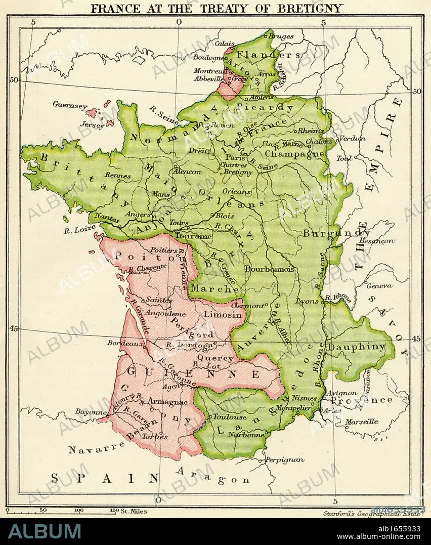
Map of France at the Treaty of Bretigny from A Short History of the English People by John Richard Green published by Macmillan and Co 1911.
| Partager |
|---|
 Pinterest Pinterest |
 Twitter Twitter |
 Facebook Facebook |
 Copier le lien Copier le lien |
 Email Email |
|
Ajouter à une autre Lightbox |
|
Ajouter à une autre Lightbox |


Avez-vous déjà un compte? S'identifier
Vous n'avez pas de compte ? S'inscrire
Acheter cette image.
Sélectionnez l'usage:

Légende:
Voir la traduction automatique
Map of France at the Treaty of Bretigny from A Short History of the English People by John Richard Green published by Macmillan and Co 1911
Crédit:
Album / Universal History Archive/Universal Images Group
Autorisations:
Taille de l'image:
4016 x 4825 px | 55.4 MB
Taille d'impression:
34.0 x 40.9 cm | 13.4 x 16.1 in (300 dpi)
Mots clés:
CARTE (GEOGRAPHIE) • CARTE GEOGRAPHIQUE • CARTE • CARTOGRAPHIE • COULEUR • DESSIN PLANS • FRANÁAIS • FRANÁAISE • FRANCE • FRANÇAIS • GENS • HISOIRE • HISTOIRE • KEN • PLAN (CARTOGRAPHIE) • PLANS • SCIENCE: CARTOGRAPHIE • VERTICALE
