alb1962027
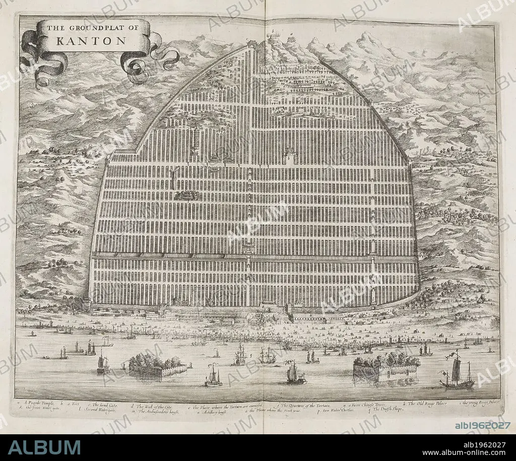
W BRAMSTON. The Ground Flat of Kanton. A map of the city of Canton in 1840. Street plan. China. . The Groundflat of Kanton. China. Canton. A Plan of the City of Canton and its Suburbs showing the principal Streets and some of the conspicuous Buildings from a Chinese Survey on an Enlarged Scale with additions and References, by W. Bramston, Late of Her Majesty’s Superintendents Office at Canton. Source: X.1202. Language: English.
| Partager |
|---|
 Pinterest Pinterest |
 Twitter Twitter |
 Facebook Facebook |
 Copier le lien Copier le lien |
 Email Email |
|
Ajouter à une autre Lightbox |
|
Ajouter à une autre Lightbox |


Avez-vous déjà un compte? S'identifier
Vous n'avez pas de compte ? S'inscrire
Acheter cette image.
Sélectionnez l'usage:

Auteur:
Légende:
Voir la traduction automatique
The Ground Flat of Kanton. A map of the city of Canton in 1840. Street plan. China. . The Groundflat of Kanton. China. Canton. A Plan of the City of Canton and its Suburbs showing the principal Streets and some of the conspicuous Buildings from a Chinese Survey on an Enlarged Scale with additions and References, by W. Bramston, Late of Her Majesty’s Superintendents Office at Canton. Source: X.1202. Language: English.
Personnalités:
Crédit:
Album / British Library
Autorisations:
Modèle: Non - Propriété: Non
Questions sur les droits?
Questions sur les droits?
Taille de l'image:
4626 x 3894 px | 51.5 MB
Taille d'impression:
39.2 x 33.0 cm | 15.4 x 13.0 in (300 dpi)
Mots clés:
ASIE • ASIE, CONTINENT • BRAMSTON, W • CARTE (GEOGRAPHIE) • CARTE GEOGRAPHIQUE • CARTE • CARTOGRAPHIE • CHINE • CITE • CONTINENT ASIE • DESSIN PLANS • DOCUMENT • PLAN (CARTOGRAPHIE) • PLAN • PLANS • SCIENCE: CARTOGRAPHIE • VILE • VILLE • XIXE SIÈCLE
