alb3803993
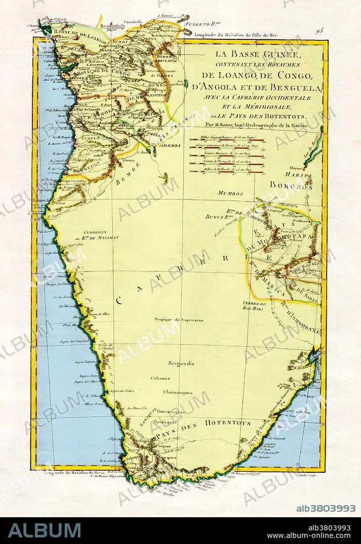
Map of Angola and the Congo, 1788
| Partager |
|---|
 Pinterest Pinterest |
 Twitter Twitter |
 Facebook Facebook |
 Copier le lien Copier le lien |
 Email Email |
|
Ajouter à une autre Lightbox |
|
Ajouter à une autre Lightbox |


Avez-vous déjà un compte? S'identifier
Vous n'avez pas de compte ? S'inscrire
Acheter cette image.
Sélectionnez l'usage:

Titre:
Map of Angola and the Congo, 1788
Légende:
Voir la traduction automatique
"The Kingdoms of Lower Guinea Including Loango, Congo, Angola, and Benguela with Kaffraria and the West Country of Meridionale or Hotentots," 1788. A general map of Angola and the Congo, showing some relief information. Created by M. Bonne, Ingenieur-Hydrographe de la Marine. This image has been color enhanced.
Crédit:
Album / Science Source
Autorisations:
Modèle: Non - Propriété: Non
Questions sur les droits?
Questions sur les droits?
Taille de l'image:
3376 x 4839 px | 46.7 MB
Taille d'impression:
28.6 x 41.0 cm | 11.3 x 16.1 in (300 dpi)
Mots clés:
