alb3842512
Cold Front, X-Band Radar, 1943
| Partager |
|---|
 Pinterest Pinterest |
 Twitter Twitter |
 Facebook Facebook |
 Copier le lien Copier le lien |
 Email Email |
|
Ajouter à une autre Lightbox |
|
Ajouter à une autre Lightbox |


Avez-vous déjà un compte? S'identifier
Vous n'avez pas de compte ? S'inscrire
Acheter cette image

Titre:
Cold Front, X-Band Radar, 1943
Légende:
Voir la traduction automatique
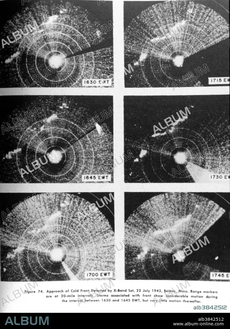
Approach of a cold front as observed on an X-Band radar set at Boston in July, 1943. This is perhaps the oldest preserved image of meteorological phenomena as observed by radar. A cold front is the forward edge of an advancing mass of cold air that pushes under a mass of warm air. Cold fronts often cause precipitation; water vapor in the rising warm air condenses and forms clouds, often resulting in heavy rain, thunderstorms, hail, or snow. Winter cold fronts can cause temperatures to drop significantly. Summer cold fronts reduce humidity as drier, cooler air displaces the humid, warmer air. On a weather map, a cold front is depicted as a blue line with triangles that point in the direction in which the cold air is moving.
Crédit:
Album / NOAA/Science Source
Autorisations:
Modèle: Non - Propriété: Non
Questions sur les droits?
Questions sur les droits?
Taille de l'image:
3000 x 4084 px | 35.1 MB
Taille d'impression:
25.4 x 34.6 cm | 10.0 x 13.6 in (300 dpi)
Mots clés:
