alb3841161
Collapsed Pingo
| Partager |
|---|
 Pinterest Pinterest |
 Twitter Twitter |
 Facebook Facebook |
 Copier le lien Copier le lien |
 Email Email |
|
Ajouter à une autre Lightbox |
|
Ajouter à une autre Lightbox |


Avez-vous déjà un compte? S'identifier
Vous n'avez pas de compte ? S'inscrire
Acheter cette image.
Sélectionnez l'usage:

Titre:
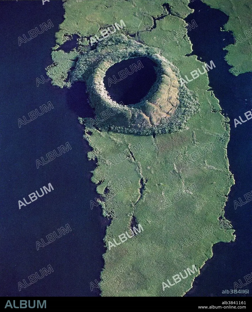
Collapsed Pingo
Légende:
Voir la traduction automatique
Collapsed pingo on the Tuktoyaktuk Peninsula in Canada. Unfrozen underground areas are sometimes engulfed by permafrost, causing that area to freeze. As it does, the pressure exerted by the expanding ice forces earth upward, forming a dome shape on the surface. This is called a pingo. Sometimes the surface of the dome cracks, exposing the underlying ice and allowing that ice to melt, which causes the dome to collapse. This is the process that has formed the topography in this image.
Crédit:
Album / NASA/Science Source
Autorisations:
Taille de l'image:
2655 x 3128 px | 23.8 MB
Taille d'impression:
22.5 x 26.5 cm | 8.8 x 10.4 in (300 dpi)
Mots clés:
