alb4067008
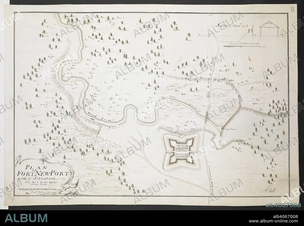
Plan of Fort Newport Fran. Pfister surv. 1760'. 1:1200. 'Scale 100 feet to one inch'. Scale bar of 200 feet (= 2 inches). 255 x 380mm. . R.U.S.I. MAPS. Vol. LXXVI (1-13). 57711 (1-4). Places in states North-East of New York. 18th century. 1760. Source: Add. 57711.13 Amherst no. A 48. R.U.S.I. no. A 30.50.
| Partager |
|---|
 Pinterest Pinterest |
 Twitter Twitter |
 Facebook Facebook |
 Copier le lien Copier le lien |
 Email Email |
|
Ajouter à une autre Lightbox |
|
Ajouter à une autre Lightbox |


Avez-vous déjà un compte? S'identifier
Vous n'avez pas de compte ? S'inscrire
Acheter cette image

Légende:
Voir la traduction automatique
Plan of Fort Newport Fran. Pfister surv. 1760'. 1:1200. 'Scale 100 feet to one inch'. Scale bar of 200 feet (= 2 inches). 255 x 380mm. . R.U.S.I. MAPS. Vol. LXXVI (1-13). 57711 (1-4). Places in states North-East of New York. 18th century. 1760. Source: Add. 57711.13 Amherst no. A 48. R.U.S.I. no. A 30.50.
Personnalités:
Crédit:
Album / British Library
Autorisations:
Modèle: Non - Propriété: Non
Questions sur les droits?
Questions sur les droits?
Taille de l'image:
8761 x 6074 px | 152.2 MB
Taille d'impression:
74.2 x 51.4 cm | 29.2 x 20.2 in (300 dpi)
Mots clés:
18 18E 18EME XVIII XVIIIE XVIIIEME SIECLE • 18E SIECLE • 18EME S • CARTE (GEOGRAPHIE) • CARTE GEOGRAPHIQUE • CARTE • CARTOGRAPHIE • DESSIN PLANS • DIX-HUITIÈME SIÈCLE • DOCUMENT • ÉVÉNEMENT • GUERRE • MILITAIRE • PLAN (CARTOGRAPHIE) • PLAN • PLANS • SCIENCE: CARTOGRAPHIE • VIE MILITAIRE ET ARMEMENT • XVIIIE SIECLE
