alb4072425
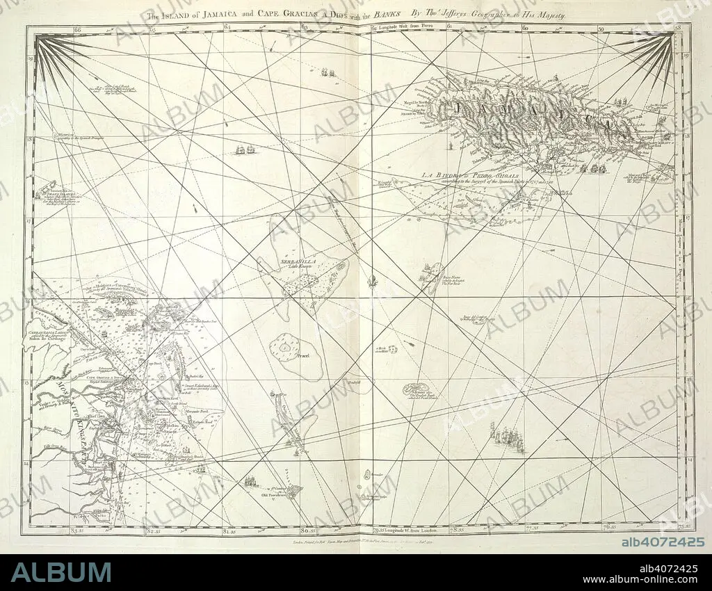
'The Island of Jamaica and Cape Gracias a Dios with the Banks'. The West-India Atlas: or, a compendious description of the West-Indies: illustrated with forty correct charts and maps ... together with an historical account of the various countries and islands ... By the late Thomas Jefferys, etc. London : Robert Sayer & John Bennett, 1775. Source: Maps C.11.b.18, no.16. Language: English.
| Partager |
|---|
 Pinterest Pinterest |
 Twitter Twitter |
 Facebook Facebook |
 Copier le lien Copier le lien |
 Email Email |
|
Ajouter à une autre Lightbox |
|
Ajouter à une autre Lightbox |


Avez-vous déjà un compte? S'identifier
Vous n'avez pas de compte ? S'inscrire
Acheter cette image.
Sélectionnez l'usage:

Auteur:
Légende:
Voir la traduction automatique
'The Island of Jamaica and Cape Gracias a Dios with the Banks'. The West-India Atlas: or, a compendious description of the West-Indies: illustrated with forty correct charts and maps ... together with an historical account of the various countries and islands ... By the late Thomas Jefferys, etc. London : Robert Sayer & John Bennett, 1775. Source: Maps C.11.b.18, no.16. Language: English.
Crédit:
Album / British Library
Autorisations:
Taille de l'image:
5880 x 4579 px | 77.0 MB
Taille d'impression:
49.8 x 38.8 cm | 19.6 x 15.3 in (300 dpi)
Mots clés:
18 18E 18EME XVIII XVIIIE XVIIIEME SIECLE • 18E SIECLE • 18EME S • CARAIBE • CARAIBES • CARTE (GEOGRAPHIE) • CARTE GEOGRAPHIQUE • CARTE • CARTOGRAPHIE • DESSIN PLANS • DIX-HUITIÈME SIÈCLE • JEFFERYS, THOMAS • MER DES CARAIBES • OCEAN ATLANTIQUE • PLAN (CARTOGRAPHIE) • PLANS • SCIENCE: CARTOGRAPHIE • XVIIIE SIECLE
