alb5482315
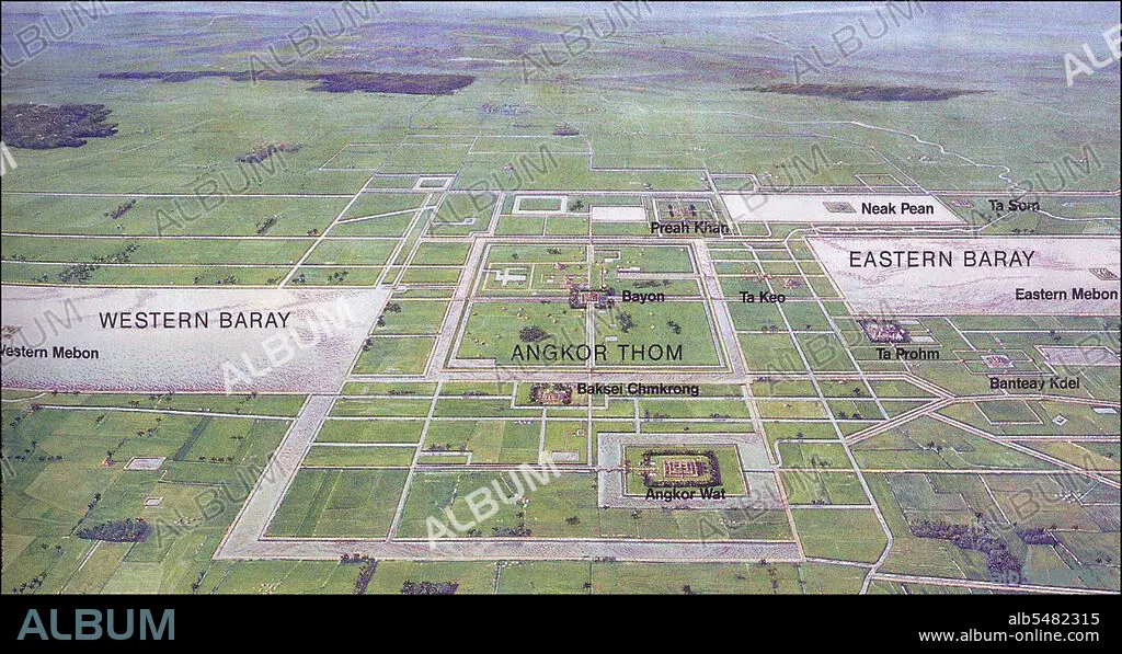
Cambodia: Diagramatic map of the major sites at Angkor, Siem Reap Province.
| Partager |
|---|
 Pinterest Pinterest |
 Twitter Twitter |
 Facebook Facebook |
 Copier le lien Copier le lien |
 Email Email |
|
Ajouter à une autre Lightbox |
|
Ajouter à une autre Lightbox |


Avez-vous déjà un compte? S'identifier
Vous n'avez pas de compte ? S'inscrire
Acheter cette image

Titre:
Cambodia: Diagramatic map of the major sites at Angkor, Siem Reap Province.
Légende:
Voir la traduction automatique
Angkor was the capital of the Khmer Empire, which flourished from approximately the 9th to 13th centuries. The word Angkor is derived from the Sanskrit nagara meaning 'city'. The Angkorian period began in AD 802, when the Khmer Hindu monarch Jayavarman II declared himself a 'universal monarch' and lasted until 1431, when Ayutthayan invaders sacked the Khmer capital, causing its population to migrate south to the area of Phnom Penh.
Crédit:
Album / Pictures From History/Universal Images Group
Autorisations:
Modèle: Non - Propriété: Non
Questions sur les droits?
Questions sur les droits?
Taille de l'image:
5815 x 3091 px | 51.4 MB
Taille d'impression:
49.2 x 26.2 cm | 19.4 x 10.3 in (300 dpi)
Mots clés:
ANGKOR WAT • ANGKOR • ASIE • ASIE, CONTINENT • CAMBODGE • CAMBODIAN • CARTE (GEOGRAPHIE) • CARTE GEOGRAPHIQUE • CARTE • CONTINENT ASIE • DESSIN PLANS • DIAGRAMME • HISOIRE • HISTOIRE • PLAN (CARTOGRAPHIE) • PLANS • SIEM REAP
