alb4091442
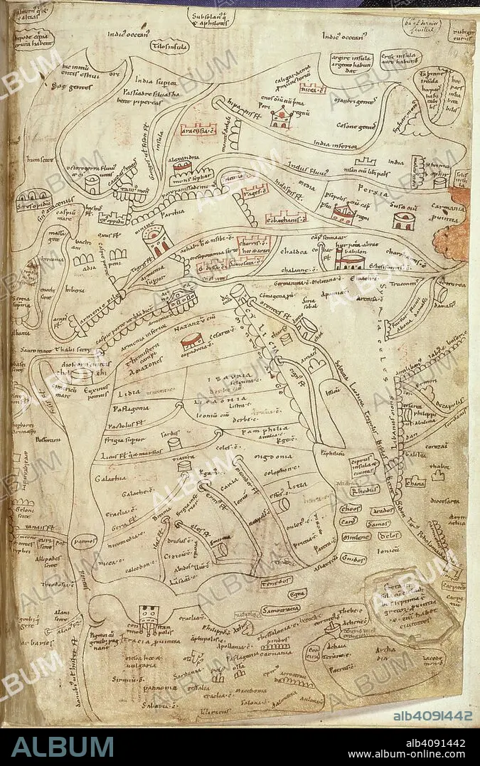
Jerome map of Asia. Works of St Jerome. France?; 12th century. (Whole folio) Map of Greece, Asia Minor, Syria, Persia and India. At the top of the map are India and the Indian Ocean with Alexandria and Damascus in the centre.The lower part of the map shows the Black Sea, Greece and Aegean Sea, and Eastern Mediterranean. Rows of semicircles represent mountains Image taken from Works of St Jerome. Originally published/produced in France?; 12th century. . Source: Add. 10049, f.64. Language: Latin.
| Partager |
|---|
 Pinterest Pinterest |
 Twitter Twitter |
 Facebook Facebook |
 Copier le lien Copier le lien |
 Email Email |
|
Ajouter à une autre Lightbox |
|
Ajouter à une autre Lightbox |


Avez-vous déjà un compte? S'identifier
Vous n'avez pas de compte ? S'inscrire
Acheter cette image.
Sélectionnez l'usage:

Légende:
Voir la traduction automatique
Jerome map of Asia. Works of St Jerome. France?; 12th century. (Whole folio) Map of Greece, Asia Minor, Syria, Persia and India. At the top of the map are India and the Indian Ocean with Alexandria and Damascus in the centre.The lower part of the map shows the Black Sea, Greece and Aegean Sea, and Eastern Mediterranean. Rows of semicircles represent mountains Image taken from Works of St Jerome. Originally published/produced in France?; 12th century. . Source: Add. 10049, f.64. Language: Latin.
Crédit:
Album / British Library
Autorisations:
Taille de l'image:
1851 x 2806 px | 14.9 MB
Taille d'impression:
15.7 x 23.8 cm | 6.2 x 9.4 in (300 dpi)
Mots clés:
AFRIQUE DU NORD • AFRIQUE • ALEXANDRIE • ANT. OR.: IRAN • ANT. OR.: SYRIE • ART PERSAN • ART SYRIEN • ASIE • ASIE, CONTINENT • CARTE (GEOGRAPHIE) • CARTE GEOGRAPHIQUE • CARTE • CARTOGRAPHIE • CONTINENT ASIE • COULEUR • DESSIN PLANS • EGYPTE • GRECE • IRAN • IRAN, ANT. OR. • MER • MYTHES: PERSES • NOIR • OCEAN • PAYSAGE MARITIME • PERSAN • PERSE • PERSES • PERSES, MYTHES • PLAN (CARTOGRAPHIE) • PLANS • SCIENCE: CARTOGRAPHIE • SYRIE • SYRIE, ANT. OR. • SYRIEN • TOPOGRAPHIE
