alb5409036
Hereford Mappa Mundi, 1300s
| Partager |
|---|
 Pinterest Pinterest |
 Twitter Twitter |
 Facebook Facebook |
 Copier le lien Copier le lien |
 Email Email |
|
Ajouter à une autre Lightbox |
|
Ajouter à une autre Lightbox |


Avez-vous déjà un compte? S'identifier
Vous n'avez pas de compte ? S'inscrire
Acheter cette image.
Sélectionnez l'usage:

Titre:
Hereford Mappa Mundi, 1300s
Légende:
Voir la traduction automatique
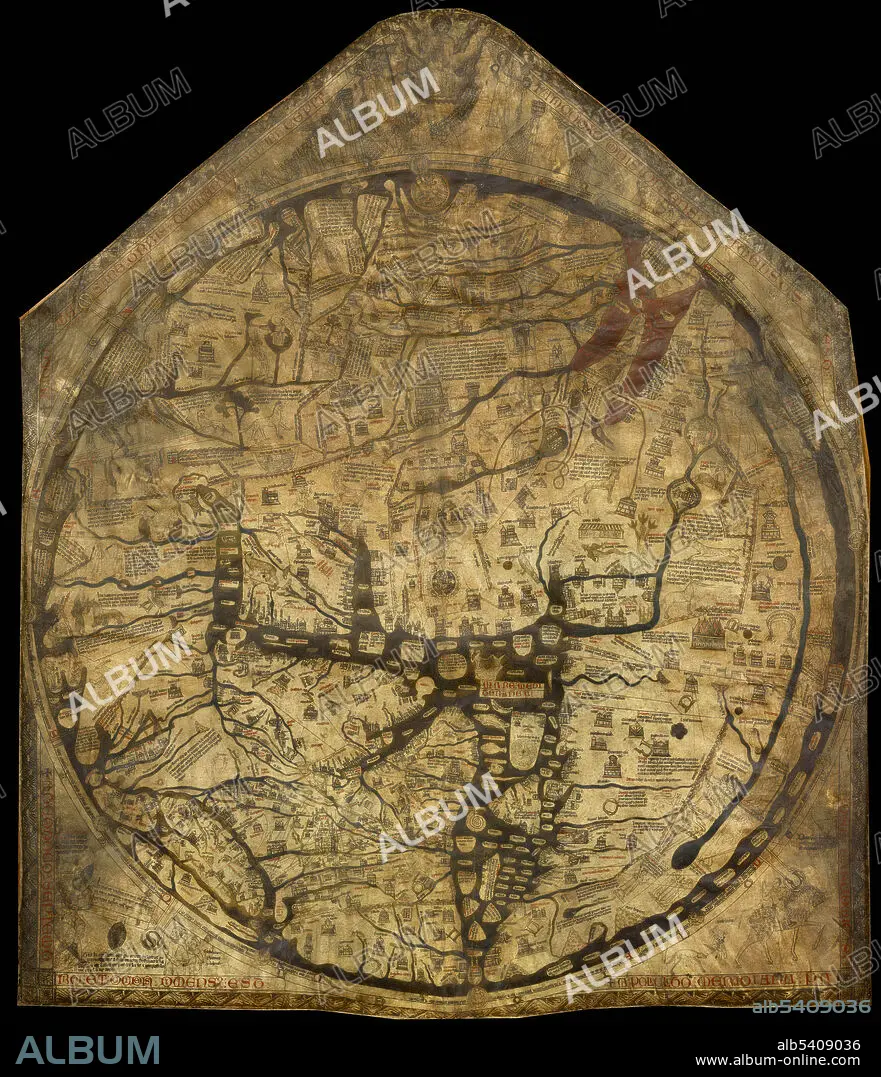
The Hereford Mappa Mundi is a medieval map of the known world, of a form deriving from the T and O pattern, dating from circa 1300. It is displayed at Hereford Cathedral in Hereford, UK. Drawn on a single sheet of vellum, it measures approximately 62 by 52 inches and is the largest medieval map known still to exist. It depicts 420 towns, 15 Biblical events, 33 animals and plants, 32 people, and five scenes from classical mythology. Jerusalem is drawn at the centre of the circle, east is on top, showing the Garden of Eden in a circle at the edge of the world. Great Britain is drawn at the northwestern border. The labels for Africa and Europe are reversed. The map is based on traditional accounts and earlier maps such as the one of the Beatus of Liebana codex, and is very similar to the Ebstorf map, the Psalter world map, and the Sawley map, it does not correspond to the geographical knowledge of the 14th century.
Crédit:
Album / Science Source
Autorisations:
Taille de l'image:
3484 x 4050 px | 40.4 MB
Taille d'impression:
29.5 x 34.3 cm | 11.6 x 13.5 in (300 dpi)
Mots clés:
CARTE • CARTOGRAPHIE • CÉLÈBRE • CELEBRITE • GEOGRAPHIE • MONDE • OECUMENISME • SCIENCE: CARTOGRAPHIE
